Catalog Archive
Auction 161, Lot 414

Rare Map of the Bay of Honduras

"A Chart of the Bay of Honduras", Speer, Joseph Smith (Capt)

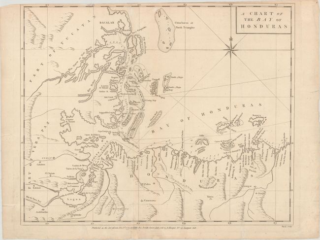
Subject: Honduras, Belize & Guatemala

Period: 1771 (dated)

Publication: The West-India Pilot

Color: Black & White

Size:
19.4 x 15.8 inches
49.3 x 40.1 cm
Download High Resolution Image
(or just click on image to launch the Zoom viewer)

A finely detailed map of the Bay of Honduras including present-day Belize and much of Guatemala and Honduras. This area was hotly contested between England and Spain throughout the colonial period. The British logwood cutters were a constant thorn in the side of the Spanish and the cluster of camps at the mouth of the Belize River (Belize City today) was one of the most ransacked settlements in the new world. The map provides an excellent view of the tortuous Atlantic coastline and shows numerous channels, anchorages, soundings, keys, reefs, shoals and islands including the popular, present-day tourist destinations of Ambergris Caye and Roatan Island. Engraved by Bayly.

Captain Joseph Smith Speer was an officer in the Royal Navy who spent many years in the West Indies. His most famous work, the West-India Pilot, contained 13 maps of the region, published in 1766, followed by an extended 26-map edition in 1771.

This map is extremely rare. We have not found any examples listed for sale in the last 35 years.

References: Kapp (MCC-106) #56; Phillips (Atlases) #2698-8; Sellers & Van Ee #2130; cf. Shirley (BL Atlases) M.SPR-1b.

Condition: B+

Issued folding, now flattened on paper watermarked "EVH" with light soiling, several extraneous creases, and archival repairs to a few tiny tears and short fold separations. The top margin is trimmed with loss of about half of the neatline at top.

Estimate: $450 - $650

Sold for: $250

Closed on 2/8/2017

Archived