Catalog Archive
Auction 161, Lot 36

Jansson's Famous Peutinger Table

"[On 4 Sheets] Tabula Itineraria ex Illustri Peutingerorum Bibliotheca...", Jansson, Jan
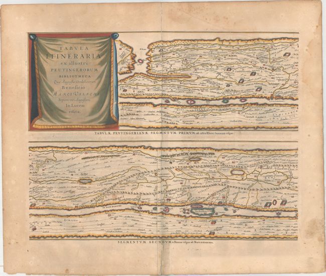
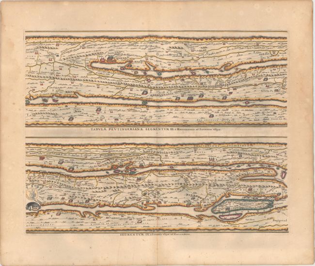
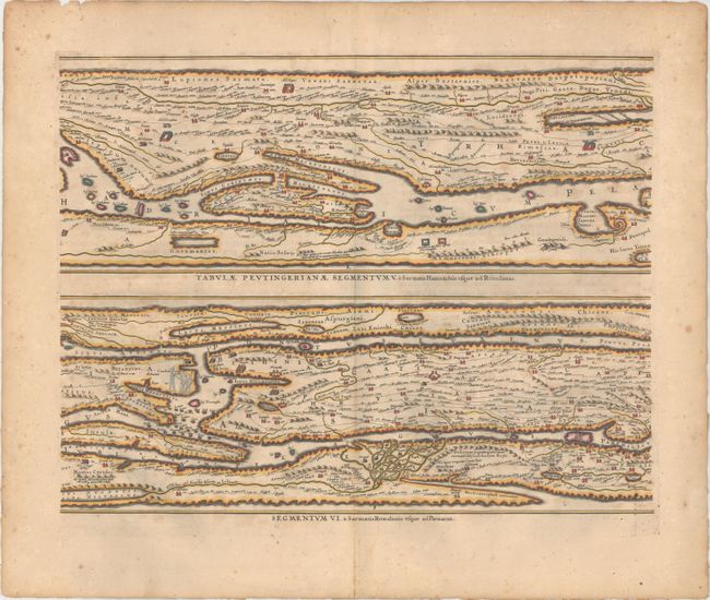
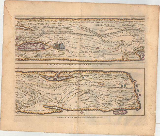
Subject: Ancient World

Period: 1662 (published)

Publication: Novus Atlas

Color: Hand Color

Size:
20.1 x 15.5 inches
51.1 x 39.4 cm
Download High Resolution Image
(or just click on image to launch the Zoom viewer)

Four sheets making up the famous Peutinger Table, or a Roman road map of the world. The original parchment document was found by Konrad Celtes in a library in Augsburg, came into the hands of Konrad Peutinger and later went to his relative Mark Welser who was the first to publish a copy of it in 1591 at Aldus Manutius in Venice. These maps, based on the original manuscript, were first popularized by Ortelius in 1598 and became an important part of his great historical atlas. Jansson's version is nearly identical to that of Ortelius. These decorative maps, in a sequence of four plates, each with two strip maps, depict the imperial roads and posts within the Roman Empire throughout Europe, North Africa and Asia as far as Toprobana (Sri Lanka). Latin text on verso.

References: Shirley #393; Van der Krogt (Vol. I) #0940/1-4:1.

Condition: B

Nice impressions with full original color. There is light scattered foxing throughout and short fold separations on all sheets confined to the bottom blank margins that have been closed on verso with archival material. The first sheet has an additional 3" fold separation near the top of the image, an extraneous crease adjacent to the centerfold, and a professionally repaired edge tear at top that enters 2" into the image. There are a few edge tears that have mostly been repaired on verso along with damp stains in the side margins that are almost entirely confined to the blank margins (touches the image on the last sheet).

Estimate: $2,500 - $3,250

Sold for: $1,600

Closed on 2/8/2017

Archived