Catalog Archive
Auction 161, Lot 329

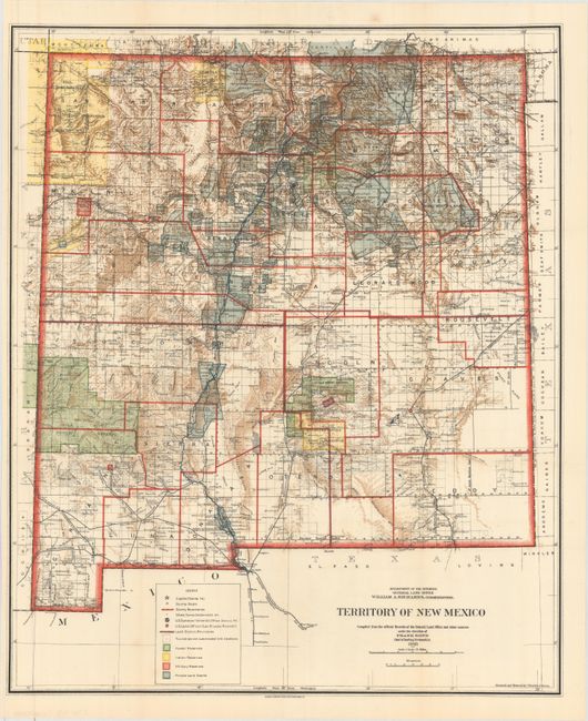
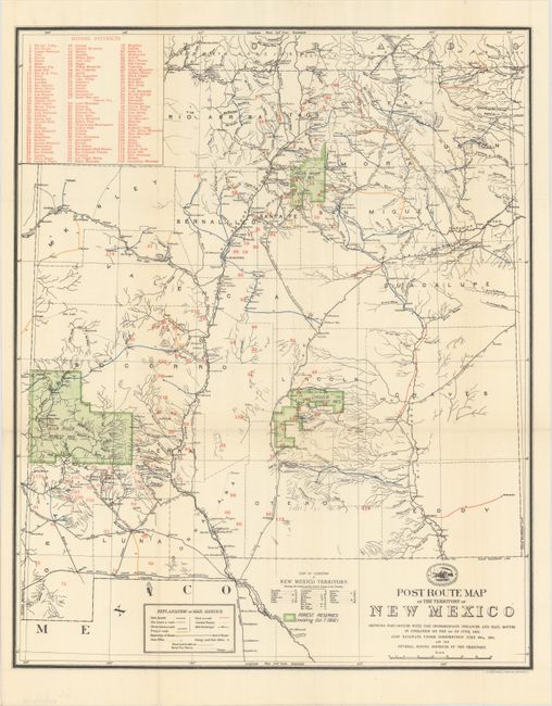
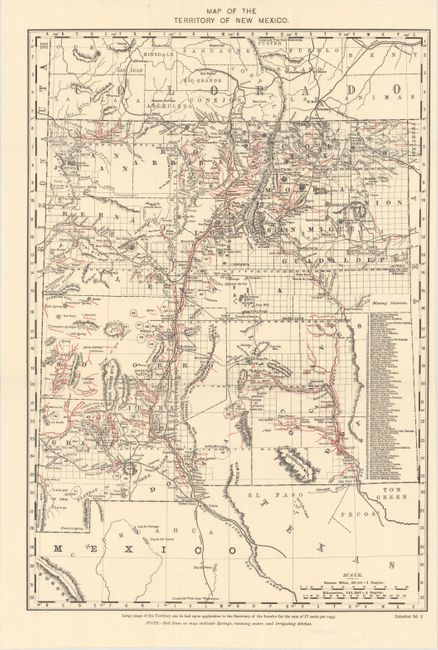
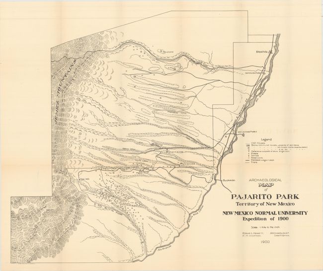
"[Lot of 4] Territory of New Mexico... [and] Post Route Map of the Territory of New Mexico... [and] Map of the Territory of New Mexico [and] Archaelogical Map of Pajarito Park Territory of New Mexico - New Mexico Normal University Expedition of 1900",

Subject: New Mexico

Period: 1900-03 (circa)

Publication:

Color:

Size:
See Description
Download High Resolution Image
(or just click on image to launch the Zoom viewer)

A. Territory of New Mexico Compiled from the Official Records of the General Land Office and Other Sources..., by General Land Office, dated 1903, printed color (18.1 x 21.7"). This colorful and fascinating map with great detail was published only nine years before New Mexico obtained statehood. The extent of existing Indian reservations, Military reservations, Forest Reserves and Private Land Grants is shown through color and hash. The map is filled with information on watershed, mountains, railroads, wagon roads, unsurveyed townships, etc. In 1903, Guadalupe county was renamed Leonard Wood and then returned to Guadalupe in 1905. This is the only map we are aware of that shows the short-lived county of Leonard Wood. The map was compiled by Frank Bond, Chief of Drafting Division and revised by Charles J. Heim.

B. Post Route Map of the Territory of New Mexico Showing Post Offices with the Intermediate Distances and Mail Routes..., by U.S. Post Office Department, circa 1902, printed color (17.1 x 21.0"). Very interesting and detailed map of the territory showing the post offices and mail routes in operation. The routes are shown with different colors to depict the frequency of service, from once a week to six times a week. The map also details the railways under construction and identifies forest reserves in green overprinting. A table in the upper corner names 116 mining districts that are numbered and located throughout the map. Above the title, the logo of the Post Office Department shows a pony express rider and a train. Printed by The Norris Peteres Co., Photo-Litho.

C. Map of the Territory of New Mexico, by U.S. Department of Interior, circa 1900, printed color (12.9 x 18.7"). This detailed map identifies 80 mining districts which are listed in a table along the right margin. A note in the lower margin states "Red lines on map indicate springs, running water, and irrigating ditches."

D. Archaelogical Map of Pajarito Park Territory of New Mexico - New Mexico Normal University Expedition of 1900, by Edgar L. Hewett, dated 1900, black & white (25.4 x 21.1"). A detailed examination of the area west of the San Ildefonso Pueblo on the Rio Grande to the Jemez Mountains. Extremely detailed at a scale of 1" per mile. An interesting map for study of the area that locates cliff houses, stone communal houses of varying sizes, defensive stone outposts, pitfalls, reservoirs, trails and wagon roads.

References:

Condition: A

All clean, bright, near fine examples with faint toning along only a few folds. Issued folding.

Estimate: $250 - $325

Sold for: $160

Closed on 2/8/2017

Archived