Catalog Archive
Auction 161, Lot 319

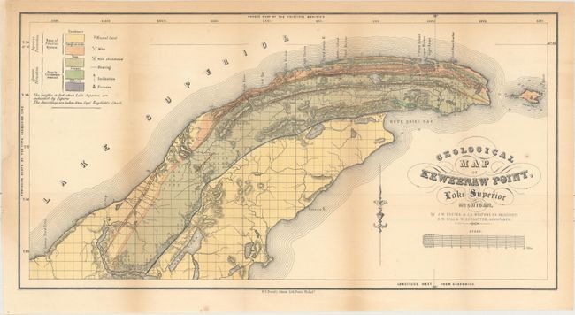
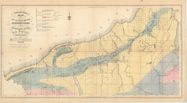
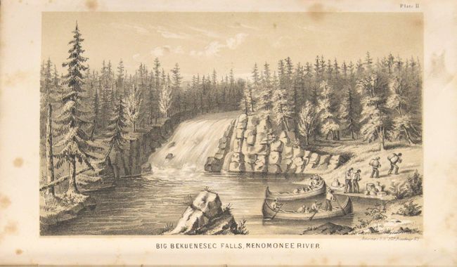
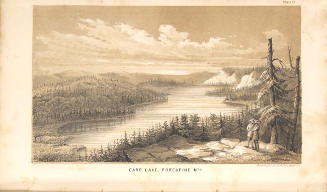
"[4 maps with Report] Report on the Geology and Topography of a Portion of the Lake Superior Land District, in the State of Michigan", Foster/Whitney

Subject: Michigan

Period: 1850 (published)

Publication: HR Doc. 69, 31st Congress, 1st Session

Color: Hand Color

Size:
6 x 9.3 inches
15.2 x 23.6 cm
Download High Resolution Image
(or just click on image to launch the Zoom viewer)

This 224 page Congressional report is focused on the geology in the Lake Superior region, and was issued shortly after J.W. Foster & J.D. Whitney took over the Survey of the Mineral Lands of Michigan in 1850. Copper deposits in the region were first reported by state geologist Douglass Houghton in 1841 which lead to a rush of prospectors, and the federal government started its own surveys beginning in the late 1840s. The copper boom in this region lasted from approximately 1850 to 1890, with the upper peninsula providing over 75% of the nation's copper output. Of particular interest are the three hand colored folding maps accompanying this report:

Geological Map of Isle Royale Lake Superior, Michigan (24.9 x 17.6"). This early geological map updates Charles T. Jackson's map of 1847. It locates sandstone, conglomerate and "Trap: Basalt, Porphyry" types with three different colors. Legend keys Mines, Abandoned Mines, Mineral Land Supposed to Contain Copper, Furnace, and more.

Geological Map of Keweenaw Point, Lake Superior Michigan (23.2 x 12.2"). Very detailed geological map that covers the region from Salmon Trout River to the tip of the point and Bete Grise Bay and also shows all of Manitou Island. A color-coded key locates geological types including sandstone, conglomerate, trap, jasper, and chlorite. Legend locates mineral land, mines, abandoned mines, furnaces, and more. Soundings are taken from Capt. Bayfield's chart.

Geological Map of the District Between Portage Lake and Montreal River Lake Superior, Michigan (29.4 x 15.4"). Covers the region from the Wisconsin border northeast to Portage Lake. Locates seven different geological types via hand coloring. A legend also identifies mineral lands, mines, abandoned mines and furnaces. Public surveys have not yet begun in the southeastern section of the map.

In addition to the three folding maps, there are 12 plates (8 of which are tinted), an additional facsimile folding map, and 55 in text figures and illustrations. Octavo, hardbound in blind-stamped brown cloth with gilt title on spine.

References: Marcou & Marcou #364, #365 and #366.

Condition: B+

The folding maps are very good with light toning and offsetting and a few spots of foxing. Two of the three maps have short binding tears that have been repaired with archival tape. Text and plates have typical light toning and scattered foxing. The binding is in excellent condition with only minimal shelf wear, which is rare for a Congressional report.

Estimate: $550 - $700

Unsold

Closed on 2/8/2017

Archived