Catalog Archive
Auction 161, Lot 312

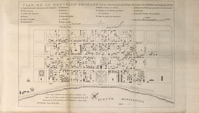
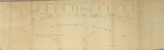
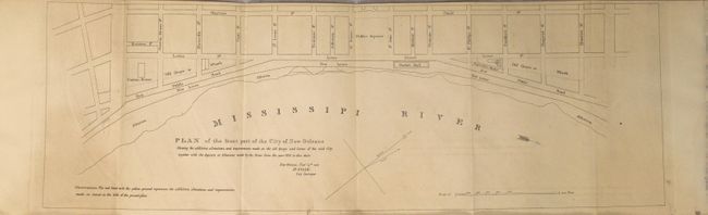
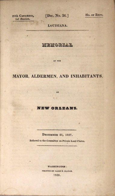
"Plan de la Nouvelle-Orleans... [and] Plan of the Front Part of the City of New Orleans in 1818 [and] Plan of the Front Part of the City of New-Orleans... [in report] Memorial of the Mayor, Aldermen, and Inhabitants, of New Orleans", U.S. Government

Subject: New Orleans, Louisiana

Period: 1828 (published)

Publication: HR Doc. 26, 20th Congress, 1st Session

Color: Black & White

Size:
See Description
Download High Resolution Image
(or just click on image to launch the Zoom viewer)

These three maps were drawn by Joseph Pilie, surveyor for New Orelans, and included in the 25 page Congressional report entitled Memorial of the Mayor, Aldermen, and inhabitants of New Orleans. The first plan shows the entire city laid out in a grid pattern with 18 important buildings identified by a key. The second and third show the first few streets that border the Mississippi River including the custom house, water works and Market Hall. The third map also shows the improvements made to the quays and levees. This is the rare original report with maps, not to be confused with the more common American State Papers edition from 1860.

A. Plan de la Nouvelle-Orleans sur les Manuscrits du Depot des Cartes de la Marine (10.9 x 7.4"). Condition: A nice impression with a small amount of toning along the lower left fold and very faint offsetting.

B. Plan of the Front Part of the City of New Orleans in 1818 (22.1 x 7.3"). Condition: Uniform light toning with very faint offsetting.

C. Plan of the Front Part of the City of New-Orleans Shewing the Additions, Alterations, and Improvements Made on the Old Quays and Levees... (22.1 x 7.3"). Condition: Uniform light toning with very faint offsetting.

References: Claussen & Friis #110, 111 & 112.

Condition: B+

See description above.

Estimate: $400 - $500

Sold for: $210

Closed on 2/8/2017

Archived