Catalog Archive
Auction 161, Lot 288

"Map of Inside Passage from Punta Rassa to Charlotte Harbor, Pine Island Sound, Florida...", U.S. Army

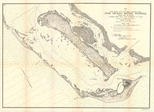
Subject: Southern Florida

Period: 1899 (dated)

Publication: HR Doc. 286, 56th Congress, 1st Session

Color: Printed Color

Size:
26.1 x 18.7 inches
66.3 x 47.5 cm
Download High Resolution Image
(or just click on image to launch the Zoom viewer)

This chart is uncolored except for red overprinting used to delineate the center of the treacherous channel near Fort Myers. Fully engraved with much inland detail it locates the islands of Captiva, Sanibel and Pine. Locates a lighthouse at the eastern tip of Sanibel Island as well as Blind Pass, Captiva Pass, Matlacha Pass, another lighthouse, with separate beacon and quarantine station on Casparilla Island, plus Charlotte Harbor, Bird Island and Shark Point. No settlements are drawn on the map but the village of St. James City is named on the southern tip of Pine Island. The Caloosahatchee River inlet to Cape Coral and Fort Myers is noted. All waterways are filled with soundings in feet at the mean low tide. The chart was prepared at the direction of Captain Henry Jervey, Corps of Engineers, September - October, 1899. Signed in the plate by Captain Jervey.

References:

Condition: B+

A dark impression with faint toning along the folds. Issued folding.

Estimate: $200 - $230

Sold for: $275

Closed on 2/8/2017

Archived