Catalog Archive
Auction 161, Lot 283

"Map of the Seat of War in Florida Compiled by Order of Bvt. Brigr. Genl. Z. Taylor, Principally from the Surveys and Reconnaissances of the Officers of the U.S. Army", U.S. War Department
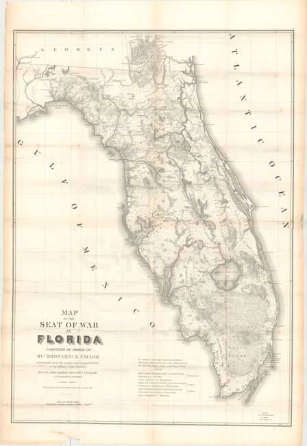
Subject: Florida

Period: 1839 (dated)

Publication:

Color: Hand Color

Size:
29 x 40.1 inches
73.7 x 101.9 cm
Download High Resolution Image
(or just click on image to launch the Zoom viewer)

This large, remarkable map of Florida at the time of the 2nd Seminole War was drawn by Capt. John Mackay and Lieut. J.E. Blake. There is great detail of Army forts, battlegrounds, Seminole villages, vegetation, hydrology, and a large network of roads and trails; many labeled with the related military action. Crossed swords are used as an icon to locate battles. Hand colored in outline to designate the District assigned to the Seminoles by the Arrangement of Gen. Macomb on May 18, 1839. The panhandle west of Tallahassee and the Ocklockonee River is not included. Printed on two sheets, joined as issued.

References: Claussen & Friis #316; Phillips (M) p. 284; cf. Schwartz & Ehrenberg, plt. 160.

Condition: B+

Overall very good for such a large map. Issued folding with some short splits at fold intersections, a few extraneous creases, and a couple of small spots. Good margins all around. There are a few small tears in the blank margins, two just entering border.

Estimate: $1,100 - $1,400

Sold for: $800

Closed on 2/8/2017

Archived