Catalog Archive
Auction 161, Lot 262

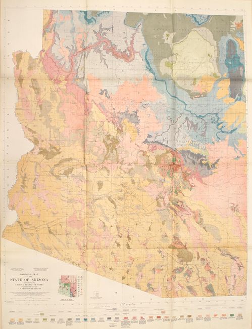
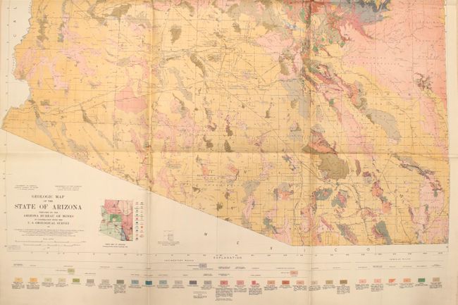
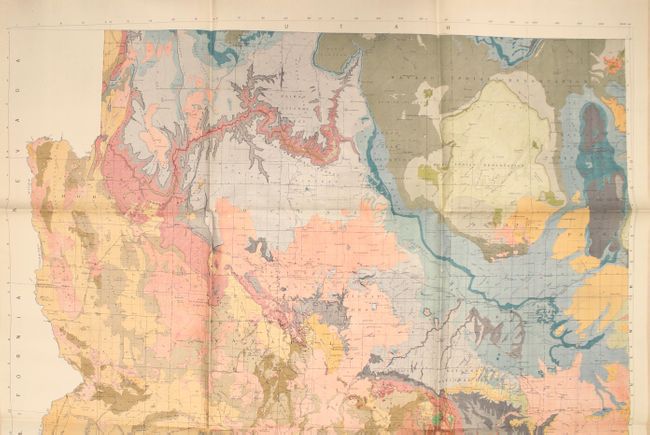
First Geologic Map of the State of Arizona

"Geologic Map of the State of Arizona", U.S. Geological Survey (USGS)

Subject: Arizona

Period: 1924 (dated)

Publication:

Color: Printed Color

Size:
42.6 x 55.1 inches
108.2 x 140 cm
Download High Resolution Image
(or just click on image to launch the Zoom viewer)

This massive lithograph was produced in partnership between the U.S. Geological Survey and the Arizona Bureau of Mines, and is the first geological map focused on the state of Arizona. Drawn on a scale of approximately 8 miles per inch, the map brilliantly illustrates 32 different geological groups through a combination of color and texture. A small inset map below the main image indicates the individuals responsible for the geological information. The underlying base map provides additional information on Indian reservations, military reservations, national forests, railroads, and more. We found no dealer listings or auction records for this map published in the last 30 years.

References:

Condition: A+

Issued folding on a clean sheet with vivid color and no fold separations, which is quite remarkable given its size. Fine.

Estimate: $200 - $250

Sold for: $75

Closed on 2/8/2017

Archived