Catalog Archive
Auction 161, Lot 243

"Map of Minnesota Territory by J.H. Young", Desilver, Charles

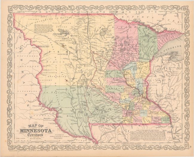
Subject: Minnesota & Dakotas

Period: 1856 (dated)

Publication: New Universal Atlas

Color: Hand Color

Size:
16.1 x 12.9 inches
40.9 x 32.8 cm
Download High Resolution Image
(or just click on image to launch the Zoom viewer)

This well engraved map is a later example of Young's notable map of Minnesota Territory, which is largely based on the works of Nicollet and Pope. County configuration is current to 1855, with the vast Blue Earth area reduced to a small square and appearances of new counties such as Dodge, Stearns, and the enormous Brown. The northwest portion of the territory is dominated by a large region labeled Pembina, which includes the large Salt Water Region and a notation discussing the brackish Minni Wakan Lake. Recent information on the treaties of Traverse des Sioux and Mendota (both signed in 1851) is contained in a note at bottom. The location of several forts on the Missouri River are shown, including Fort Mandan, where Lewis & Clark are noted to have wintered in 1804-05. A road surveyed by Captain Renno in 1853 is also delineated. The territory was created in 1849 and granted statehood in 1858. Published by Charles Desilver in 1856.

References:

Condition: B+

Original color with occasional faint scattered foxing and minor toning along sheet edges, away from the map image.

Estimate: $240 - $300

Sold for: $120

Closed on 2/8/2017

Archived