Catalog Archive
Auction 161, Lot 236

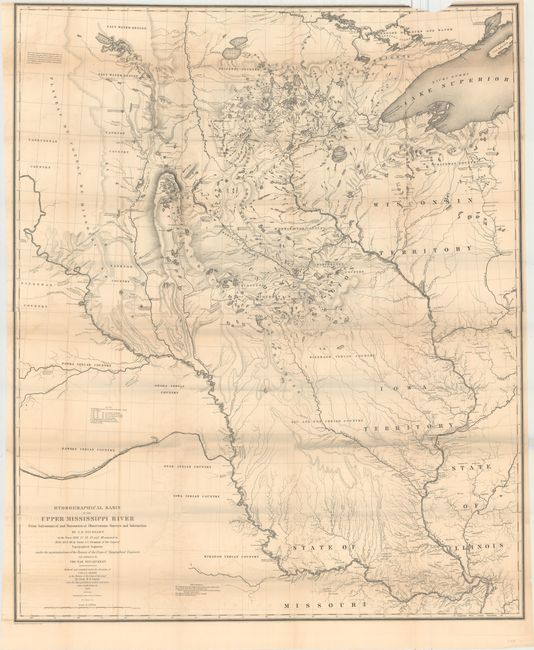
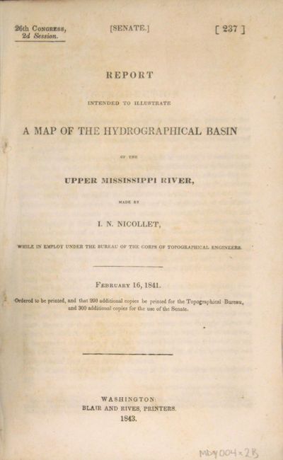
"Hydrographical Basin of the Upper Mississippi River from Astronomical and Barometrical Observations Surveys and Information... [with report] Report Intended to Illustrate a Map of the Hydrographical Basin...", U.S. War Department

Subject: Central United States

Period: 1843 (published)

Publication: Sen. Ex. Doc. No. 237, 26th Congress, 2nd Session

Color: Black & White

Size:
30.6 x 36.5 inches
77.7 x 92.7 cm
Download High Resolution Image
(or just click on image to launch the Zoom viewer)

This extremely important map is the first accurate map of the interior region stretching from St. Louis north to the international boundary. The map was compiled by Lt. W. H. Emory (under the direction of Col. J. J. Albert) from the surveys of J. N. Nicollet, who was assisted by Lt. J. C. Fremont; thus, bringing together some of the most important names in the history of American mapping in the 19th century. Nicollet, already a noted French scientist and topographer, was chosen to lead this expedition during 1838 to 1840. The map reflects, for the first time, the use of the barometer to obtain elevations and the use of place names on maps based on a systematic analysis of Indian and French names. It is the first truly scientific topographical survey of the interior of North America. Contemporary cartographer, Lt. G. K. Warren, called it "one of the greatest contributions ever made to American geography." Lithographed by C. B. Graham and printed on two joined sheets.

Offered with the original "Report Intended to Illustrate a Map of the Hydrographical Basin of the Upper Mississippi River" (6" x 9") by Nicollet which describes his remarkable explorations on behalf of the Bureau of Topographical Engineers. A note explains Nicollet died while writing the introduction. 8vo, 170pp, folding map loose. Hardbound in modern quarter faux leather over marbled paper boards.

References: Claussen & Friis #390; Schwartz and Ehrenberg, p. 267-268, plt. 165.

Condition: B+

Condition grade is for the map, which is a dark impression with light offsetting and toning. There short splits at the fold intersections and a small chip at top right, just entering the map border. The text has minor toning and foxing, and the new covers are pristine.

Estimate: $600 - $750

Sold for: $475

Closed on 2/8/2017

Archived