Catalog Archive
Auction 161, Lot 207

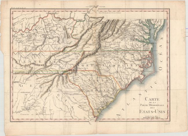
"Carte de la Partie Meridionale des Etats-Unis", Crevecoeur, Michel Guillaume De

Subject: Southeast United States

Period: 1801 (published)

Publication: Voyage dans la Haute Pennsylvanie

Color: Hand Color

Size:
20.1 x 15.2 inches
51.1 x 38.6 cm
Download High Resolution Image
(or just click on image to launch the Zoom viewer)

This finely engraved map describes the southern portion of the United States at the turn of the century. The map extends from Savanna to the Chesapeake Bay and east to show Kentucky, Tennessee, and the Western Territory above the Ohio River. A thin strip of land extending westward between Georgia and Tennessee is called United States Territory. This region originally belonged to South Carolina but was ceded back to the United States in 1787. The map is filled with a remarkable number of place names and details including a well developed road system within the nascent nation. A large amount of information on Indian tribes and villages is included. The map is from Crevecoeur's three volume work Voyage dans la Haute Pennsylvanie. Crevecoeur was a French immigrant to the United States who gained notoriety describing the emerging American national character in his Letters of an American Farmer (1782). Engraved by Tardieu.

References:

Condition: B+

A nice impression, issued folding, with light offsetting, light toning and soiling along some of the folds, and a short fold separation confined to the top blank margin.

Estimate: $400 - $500

Sold for: $250

Closed on 2/8/2017

Archived