Catalog Archive
Auction 161, Lot 182

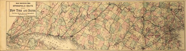
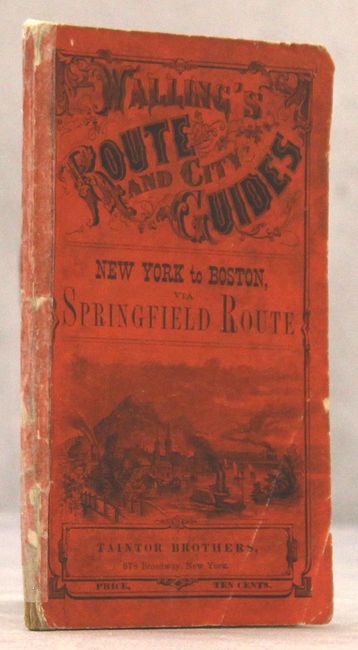
"Map Showing the Springfield Route Between New York and Boston... [in] Walling's Route and City Guides New York to Boston...", Walling, Henry F.

Subject: New England - United States

Period: 1868 (published)

Publication:

Color: Hand Color

Size:
20.9 x 5.7 inches
53.1 x 14.5 cm
Download High Resolution Image
(or just click on image to launch the Zoom viewer)

This folding map covers the region from New York City to Boston and highlights the Springfield Route. Also shows numerous other railroads in the region as well as cities, towns, and counties. The map is still bound into a 46 pp. promotional booklet with "descriptive sketches of cities, villages, stations, scenery and objects of interest along the routes." Includes numerous advertisements throughout and bound in orange pictorial wrappers (3.7 x 6.0"). Published by the Taintor Brothers in New York.

References:

Condition: B+

The map is lightly toned with two tiny fold separations that have been closed on verso with archival tape. Text is very good with a few pages that are slightly dog-eared. Paper wrappers are moderately worn and the spine is reinforced with archival tape.

Estimate: $120 - $150

Sold for: $90

Closed on 2/8/2017

Archived