Catalog Archive
Auction 161, Lot 151

"Carte Generale des Etats Unis de l'Amerique Septentrionale", Vivien de Saint Martin, Louis

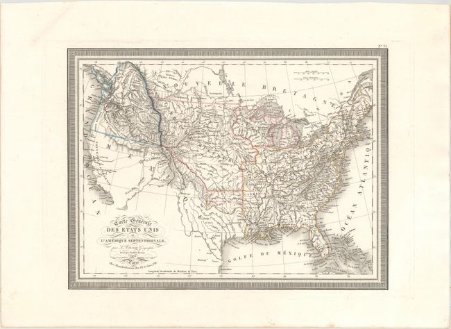
Subject: United States

Period: 1825 (dated)

Publication: Atlas Universel pour Servir a l'Etude de la Geographie et de l'Histoire...

Color: Hand Color

Size:
16.1 x 12.3 inches
40.9 x 31.2 cm
Download High Resolution Image
(or just click on image to launch the Zoom viewer)

This handsome map of the United States extends to include part of Canada. The map features the 54-40 or Fight border with the huge Northwest region extending well into British Columbia. The entire Northwest is labeled Columbia and shows several rivers emptying into the Pacific that have dubious sources in lakes to the west of the Rockies. The area of today's Missouri is divided into three areas: Howard, St. Louis, and C. Girardeau. Arkansas is half its current size, with the northern half called Lawrence. The map shows Mexico in control of the entire Southwest just four years after winning independence from Spain with the signing of the Treaty of Cordoba. Finely engraved by Giraldon-Bovinet and published in Paris by Menard and Desenne. Crisp engraved line and full keyboard-style border.

References: Wheat (TMW) #365.

Condition: A

A dark impression on a clean sheet with a professionally repaired edge tear confined to the top left blank margin.

Estimate: $220 - $250

Sold for: $120

Closed on 2/8/2017

Archived