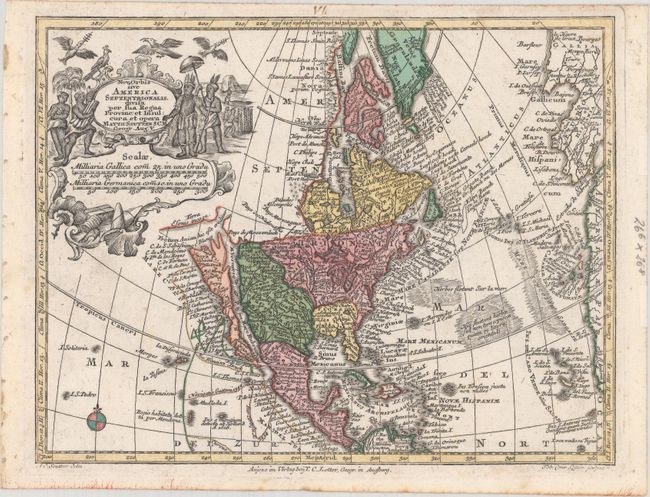
"Nova Orbis sive America Septentrionalis, Divisa per sua Regna Provinc: et Insul", Seutter/Lotter
Subject: Colonial North America
Period: 1740 (circa)
Publication:
Color: Hand Color
Size:
10.1 x 7.8 inches
25.7 x 19.8 cm
A superb small map with California as an island on the second Sanson model, showing two bays on the north end of the island. The island is also very narrow in the center, almost becoming two islands, a theory proposed by Father Luis Velarde. The map is densely covered with place names, and the northern extremes are strangely elongated. The large title cartouche, surrounded by Native Americans and birds conveniently obscures the northwest coast with the exception of a portion of the Terra Esonis incogn. Tobias Conrad Lotter's strong engraving style is evident. This is the third state per McLaughlin.
References: McLaughlin #221; Tooley (America) #95.
Condition: A
A clean and bright example with original color, marginal foxing, and binding holes at far left. Remnants of hinge tape on verso.