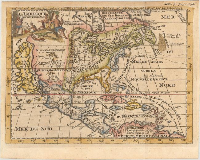
"L'Amerique Septentrionale", Martineau de Plessis, Denis
Subject: Colonial North America
Period: 1700 (published)
Publication: Nouvelle Geographie, ou Description Exacte de l'Univers...
Color: Hand Color
Size:
7.6 x 5.6 inches
19.3 x 14.2 cm
This map predates Daniel de La Feuille's map of the same name by two years but is cartographically identical. It features a huge island of California with an indented coastline and the place names R. d' Estate, C. Blanco, P. de Carinde, Canal de S. Barbee, I. de S. Martin, I. de S. Mare, B. de S. Francisco, B. de Simon, B.S. Christoue, and Piemabe. The British Colonies extend from New England west past the Mississippi River, which is depicted far too west with its mouth located by the Rio Grande. The Spanish colony of La Floride includes Carolina (Caroline). Columbus' expedition to and from the West Indies is also depicted. A quaint title cartouche features a crocodile, serpent, and natives tending a fire. Published in Denis Martineau de Plessis' Nouvelle Geographie, ou Description Exacte de l'Univers....
References: cf. McLaughlin #147.
Condition: A
Nice impression and color.