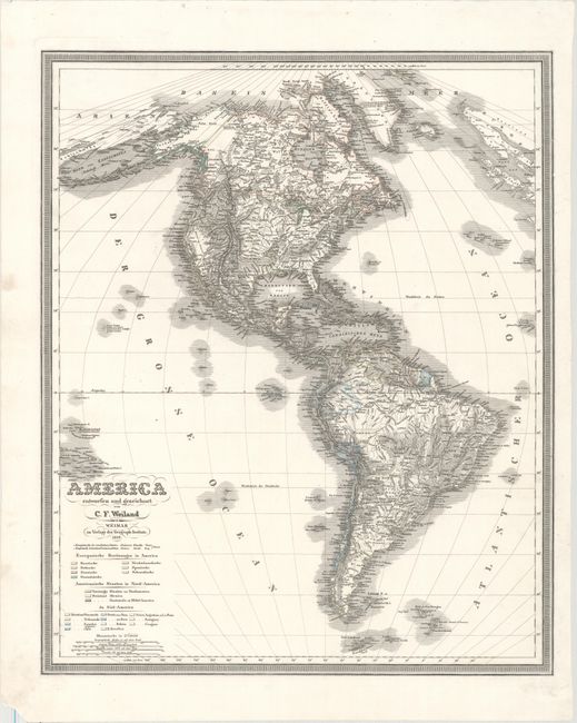
"America Entworfen und Gezeichnet...", Weiland, Carl Ferdinand
Subject: Western Hemisphere - America
Period: 1839 (dated)
Publication:
Color: Hand Color
Size:
19.7 x 23.8 inches
50 x 60.5 cm
This superb German map of the Americas is engraved with fine topographical detail as well as hundreds of place names. In North America, Alaska is still a bit misshapen with the interior noted as unexplored. The United States' northern boundary encroaches into present-day British Columbia. The islands in both the Atlantic and Pacific are well delineated. Color key below the title identifies the various colonial possessions in the Americas. The map is enclosed in a keyboard-style border.
References:
Condition: A
A nice impression with a couple tiny worm holes in the map image and a chip at bottom left, well away from the image.