Important Account of European Colonization Complete with 7 Maps by Kitchin
"[8 Volumes] A Philosophical and Political History of the Settlements and Trade of the Europeans in the East and West Indies...", Raynal, Abbe
Subject: Exploration & Surveys
Period: 1788 (published)
Publication:
Color: Black & White
Size:
5.4 x 8.6 inches
13.7 x 21.8 cm
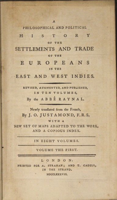
This important account of European settlement and colonization was Raynal’s greatest achievement. It provides a complete and insightful survey of trade and colonization throughout the New World and Asia including extensive descriptions of the discoveries, wars, conquests, settlements, trade routes, agriculture, and missionary activity. This edition is expanded to include a contemporary account of the American Revolution. Raynal’s controversial indictment of slavery and critical examination of colonization resulted in the banishment of his work by the French parliament. The work was enormously popular and was translated into several languages. It is a key piece of democratic writing in the period leading up to the French Revolution.
This expanded English edition was translated by J. O. Justamond and is illustrated with seven fine maps by Thomas Kitchin, including maps of the world, Europe, Africa, East Indies, South America, Mexico and West Indies, and the fledgling United States:
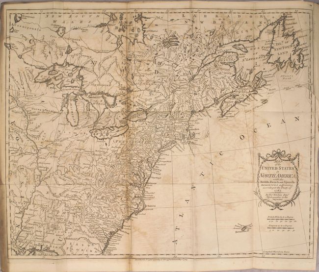
A. Map of the United States in North America: with the British, French and Spanish Dominions Adjoining, According to the Treaty of 1783 (19.9 x 16"). This is one of the earliest English-produced maps to officially acknowledge the United States. It depicts the new nation with its western border on the Mississippi River. The states of Georgia, South Carolina, North Carolina, and Virginia stretch from the Atlantic to the Mississippi. The map is filled with information on early settlements, forts, Indian villages and fishing banks. The title is enclosed in a simple cartouche, with the island of Bermuda below. The map is dated May 1st, 1783. Reference: McCorkle #783-11.
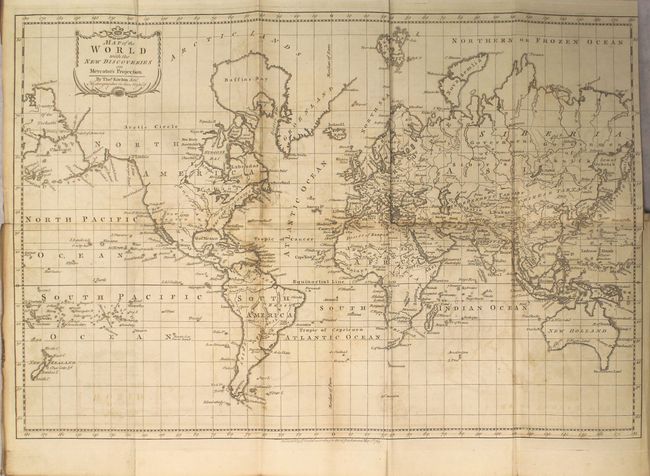
B. Map of the World with the New Discoveries on Mercator's Projection (19.8 x 13.3"). This map presents an interesting view of the world in 1783 with emphasis on British interests and discoveries. The Eastern U.S. is still labeled British Colonies. The remainder of North America lacks boundaries, although the areas of New Albion, New Mexico, Louisiana, and Canada are named. San Francisco Bay is named Port Sir Francis Drake. The islands of the Pacific Ocean receive special attention, highlighting the discoveries of Capt. Cook, with O-Why-Hee featured within the Sandwich Islands. Australia (New Holland) is almost fully delineated, except Tasmania (Van Diemens Land) is shown attached to the mainland. Asiatic Russian is made up of the Government of Siberia and the Government of Irkutsk. Cook’s Str. separates Asia and North America.
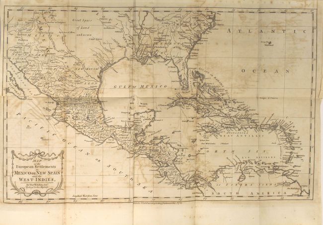
C. Map of the European Settlements in Mexico or New Spain and the West Indies (19.9 x 12"). This detailed and expansive map covers all of the southern United States north to the Carolinas and Cape Henry. The map continues west through the region labeled Great Space of Land unknown to the southern tip of Baja California. All of the Caribbean is shown, naming the Great Antilles, Cuba, and the Bahamas, with the Windward and Leeward together identified as the Caribbe Is. It is filled with place names, rivers and Indian tribes.
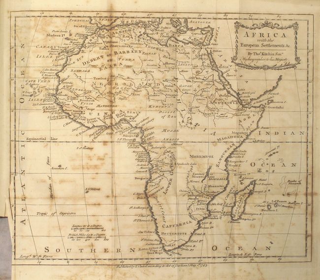
D. Africa with the European Settlements &c. (11.3 x 9.3").
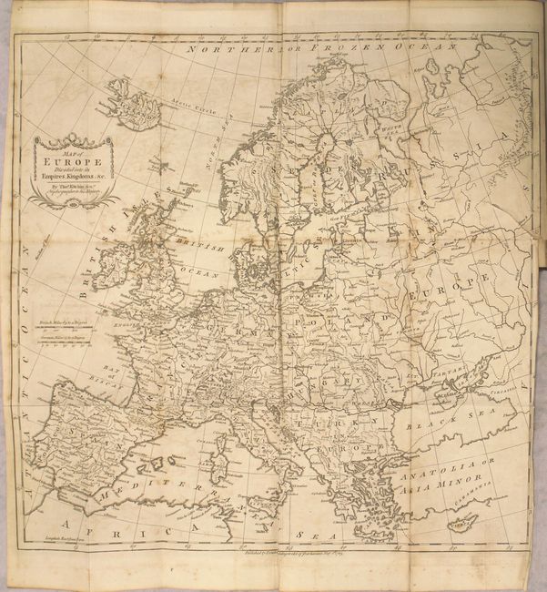
E. Map of Europe Divided into its Empires, Kingdoms, &c. (16.7 x 16.2").
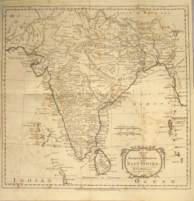
F. Map of the European Settlements in the East Indies (13.7 x 13.3").
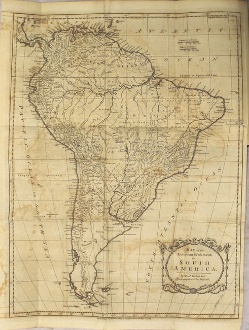
G. Map of the European Settlements in South America (13.3 x 17.2").
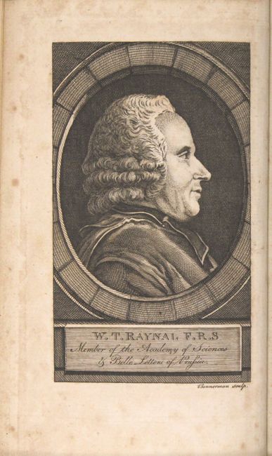
Also included is a portrait of Raynal. Published by Strahan and Cadell in London. Hardbound in original calf with gilt embossed spines, black leather title labels, and marbled endpapers.
References: Sabin #68089.
Condition: B
The maps are in good condition with light to moderate offsetting, foxing, toning along the folds, occasional short fold separations, and binding tears ranging in length from 0.5" to 2". The text is very good with very light, scattered foxing. The hinges are starting on several of the volumes, and the front cover of volume VIII has been reattached with archival materials. The covers and spines are moderately worn, the spines are cracking, and four of the sixteen title labels are missing.