"[Lot of 4] Victoria, or Port Phillip [and] Western Australia, Swan River [and] New South Wales [and] Van Diemen's Island or Tasmania", Tallis, John
Subject: Australia
Period: 1850 (circa)
Publication: Illustrated Atlas and Modern History of the World
Color: Hand Color
The maps from The Illustrated Atlas were first published in serial form to a target audience that led insular lives due to the expense and hardship of travel. All that changed as the progress of the nineteenth century brought swift and dramatic changes in public awareness of far away places. Tallis' maps no doubt played an important role in this dramatic awakening. These maps not only provided up-to-date geographical knowledge, but also used vignette views within the map's design to show the native people and their occupations, cities and points of interest. The maps hark back to a cartographic tradition from the Dutch mapmakers of the seventeenth century with finely engraved decorative borders. The maps were drawn and engraved by John Rapkin with views drawn and engraved by a number of prominent artists. The maps were issued as a complete volume from 1851 until about 1865. Some of the maps were also published in other history books published by Tallis including British Colonies and, without the vignettes, in geographical dictionaries and encyclopedias until about 1880.
A nice set of steel-engraved maps with decorative borders representing Tallis' complete view of Australia:
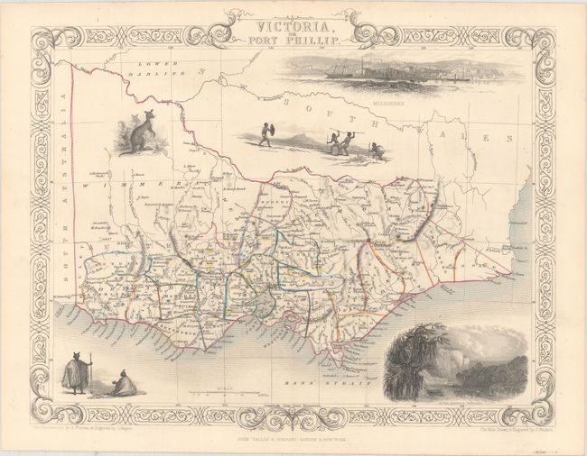
A. Victoria, or Port Phillip (12.8 x 10.3"). Superb map of Victoria roughly centered on Melbourne. Vignettes of Aborigines, a kangaroo, the River Glenelg, Victoria and a large view of Melbourne across the water with a sailing ship and two early steam ships maneuvering in the foreground.
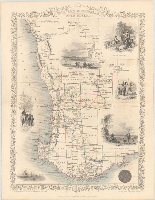
B. Western Australia, Swan River (9.6 x 13.6"). Lovely map of southwestern Australia centered on Perth and detailing its vicinity down to Doubtful Island Bay and north to above Champion Bay. Twenty five counties are named and delineated via hand coloring. Surrounded with seven vignettes including views between Perth and Freemantle, Perth from Mount Eliza, sheep herding and shearing, and one showing Aborigines with spears and shields.
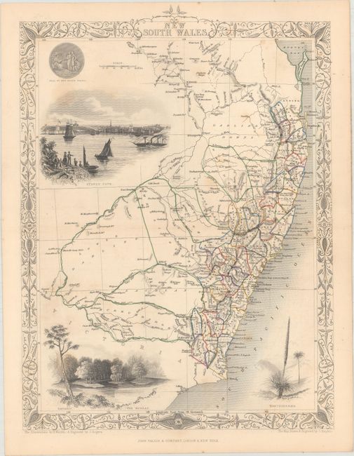
C. New South Wales (9.9 x 13.5"). Attractive map of New South Wales with remarkable detail along the coastline. The map indicates the locations of the gold diggings, heralding the beginning of the Australian Gold Rush of 1851. It is surrounded by well-rendered vignettes of the Seal of New South Wales, Sydney Cove, The Murray and an agave-type plant namedXanthorrhaea. The large vignette of Sydney presents a lovely view from the harbor.
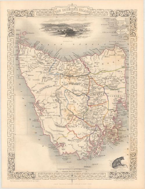
D. Van Diemen's Island or Tasmania (9.9 x 13.5"). This decorative steel-engraved map of the island with good detail of cities, rivers, boundaries, and topography. The map features three well-rendered vignettes: Hobart Town, a Tasmanian Tiger (Thylacinus Cynocephalus), and the Residence of the V.D.L. Company's Agent, Circular Head. The V.D.L. (Van Diemen’s Land) Company was a large landholder in the north west corner of Tasmania.
References:
Condition: B+
Original outline color with occasional faint spots of foxing.