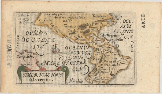
"Americae Nova Descriptio ", Bucelin, Gabriel
Subject: Western Hemisphere - America
Period: 1658 (published)
Publication: Praecipuarum Universi Terrarum Orbis
Color: Hand Color
Size:
4.1 x 2.5 inches
10.4 x 6.4 cm
This tiny map is based on the Ortelius-Galle pocket map of America and updated with more recent nomenclature such as Virginia, Nova Granata, and Terra Nova. One interesting feature is the depiction of the Amazon River running across the entire South American continent. Terra Australis incognita appears above the title cartouche. Bucelin's maps in his Praecipuarum Universi were copperplate engravings based on the Ortelius miniature maps. His atlas contained 30 maps and was published by Johann Praetorius and Johann Gorlinus in 1658 and 1664. Bucelin's maps are very scarce. Latin text on verso.
References: Burden #329; King (2nd ed.) pp. 126-127.
Condition: A
A nice impression with light show-through of text on verso and minor toning along the edges of the sheet.