Catalog Archive
Auction 160, Lot 72

Jansson's Decorative Map of the Americas

"America Noviter Delineata", Hondius/Jansson

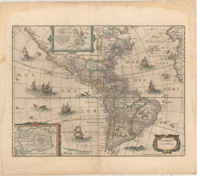
Subject: Western Hemisphere - America

Period: 1646 (circa)

Publication: Atlas Novus

Color: Hand Color

Size:
19.8 x 14.8 inches
50.3 x 37.6 cm
Download High Resolution Image
(or just click on image to launch the Zoom viewer)

This beautiful and popular map of the Americas was emulated by numerous cartographers and went through various editions. Originally issued by Jodocus Hondius II in 1618 with carte-a-figures borders, it was derived from two earlier maps by Blaeu. North America retains the peninsular California and the East Coast is beginning to take shape, although it still lacks detail in the mid-Atlantic region. In the Southwest, the famous seven cities of Cibola appear on the banks of a large lake. In South America, there is a large inland sea on the equator and two engraved scenes - one detailing a cannibalistic feast. Two stylized insets of the polar regions are enclosed in strapwork cartouches; the North Pole depicts Frobisher's theory of the Northwest Passage and the South Pole shows the long-held notion of the mythical southern continent. The map is richly ornamented with a strapwork title cartouche, fleets of ships and sea monsters.

Shortly after Jodocus Hondius' death in 1629 the plate passed into the hands of his brother, Henricus. The borders were removed to facilitate the smaller atlas. This is the fifth state with the imprint of Ioannes Ianssonius below the cartouche. Latin text on verso, published between 1646-57.

References: Burden #192; Goss #27; Tooley (America) plt. 172; Van der Krogt (Vol. I) #9000:1D.4.

Condition: B+

Occasional light scattered foxing with centerfold separations at top and bottom that have been closed on verso with archival materials. There is a damp stain that is confined to the top, left, and right blank margins.

Estimate: $2,000 - $2,300

Sold for: $1,500

Closed on 11/16/2016

Archived