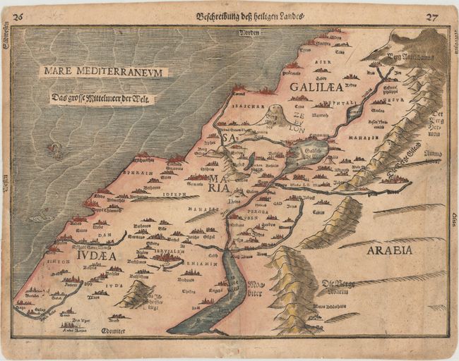
"Beschreibung dess Heiligen Landes", Bunting, Heinrich
Subject: Holy Land
Period: 1600 (circa)
Publication: Itinerarium Sacrae Scripturae
Color: Hand Color
Size:
14.8 x 10.6 inches
37.6 x 26.9 cm
Woodblock map of the Holy Land divided among the twelve tribes of Israel. The cities, mountains, rivers and seas are graphically presented and the Dead Sea is shown in a crescent shape. Three sea monsters frolic in the Mediterranean. German text on verso.
References: Laor #141.
Condition: C+
Two large chips in bottom corners have been replaced with period-correct paper with the image skillfully replaced in facsimile. The triangular chip at bottom left measure 4" high and 3" wide, and the chip at bottom right measures 5.5" high and 2" wide. An additional small hole near the center of the map has also been repaired with a minor amount of image replaced in facsimile. The restoration has been very well executed and the map presents itself well.