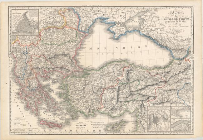
"Carte de l'Empire de Turquie, en Europe et en Asie, avec les Etats et Pays Circonvoisins", Herisson, Eustache
Subject: Black Sea, Crimean War
Period: 1853 (dated)
Publication:
Color: Hand Color
Size:
32.6 x 22.7 inches
82.8 x 57.7 cm
This handsome map was issued at the beginning of the Crimean War and covers the region surrounding the Black Sea including present-day Greece, Bulgaria, Romania, Ukraine, Russia, Georgia, and Turkey. It shows the position of both Russian and Turkish troops along the Black Sea's western edge (Romania and Bulgaria) along with cities, towns, forts and roads. The highly detailed topography is graphically illustrated with a three-dimensional appearance. Includes inset plans of Istanbul, Shumen, Varna, and Silistra. Engraved by J.B. Tardieu.
References:
Condition: B+
A crisp impression with two edge tears that just enter the image and a tiny tear along the centerfold that have all been closed on verso with archival material.