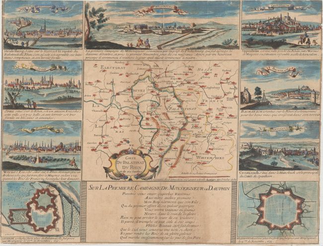
"Carte du Palatinat du Rhin et de ses Confins", Jollain, Gerard
Subject: Southwestern Germany, Northeastern France
Period: 1688 (circa)
Publication:
Color: Hand Color
Size:
10 x 7.8 inches
25.4 x 19.8 cm
This small map covers the County Palatine of the Rhine, one of the oldest electorates of the Holy Roman Empire. It covers present-day southwestern Germany and northeastern France, flanking the Rhine River. The map is surrounded by bird's-eye views of several important cities in the region including Philippsbourg, Heidelburg, and Worms along with fortified plans of Mannheim and Frankenthal. A note below the map describes how Louis, Grand Dauphin, took this region for France during the War of the Grand Alliance. The full sheet with illustrations measures 20.6 x 15.8".
References:
Condition: B
On watermarked paper that has been trimmed to the neatline on all sides with minute loss of image. There is light toning and a 1" fold separation at top that has been closed on verso with tissue.