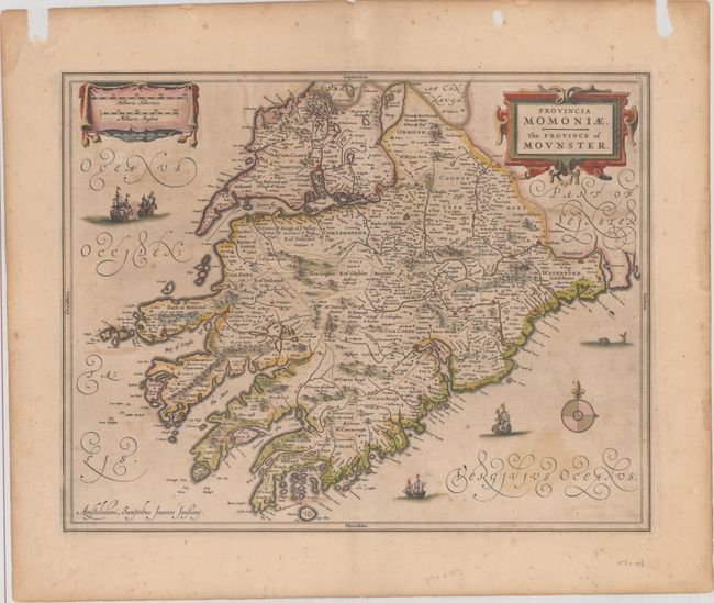
"Provincia Momoniae / The Province of Mounster", Jansson, Jan
Subject: Southwestern Ireland
Period: 1646 (circa)
Publication: Nouvel Atlas...
Color: Hand Color
Size:
19.4 x 15.1 inches
49.3 x 38.4 cm
This decorative map details the southwestern Irish province of Munster. Munster is the largest of the four provinces, with the counties of Limerick, Waterford, Cork, Clare and more. Many places are named including Tipperary, Bantry Bay and the Dingle Peninsula. The sea is decorated with ships, a sea monster, and a compass rose. A drape-style cartouche and a strapwork cartouche fill the top corners of the map. Latin text on verso, published between 1646-59.
References: Van der Krogt (Vol. I) #5920:1.
Condition: B+
Original outline color with faint color offsetting and scattered foxing. There are three chips in the top blank margin, far away from the map image.