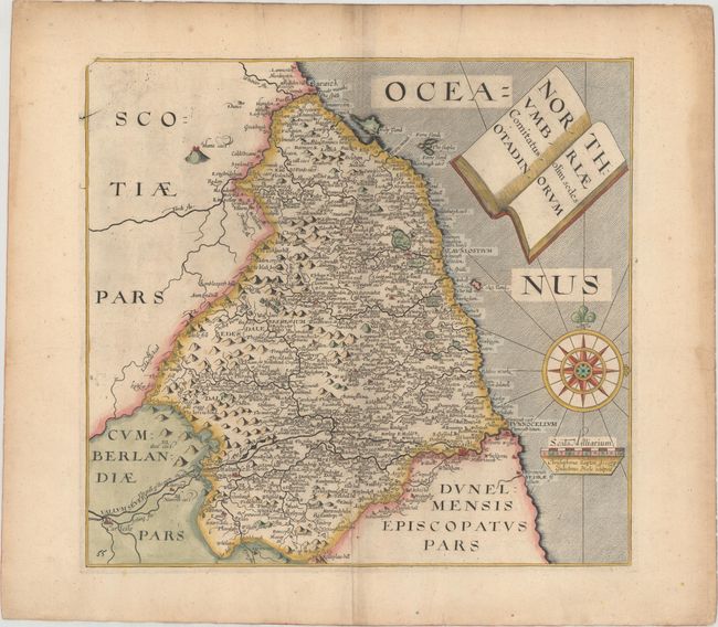
"Northumbriae Comitatus olim sedes Otadinorum", Saxton/Hole
Subject: Northern England
Period: 1637 (published)
Publication: Camden's Britannia
Color: Hand Color
Size:
11.6 x 10.8 inches
29.5 x 27.4 cm
This handsome chart of Northumbria identifies Newcastle, Barwick, Glinda and hundreds of smaller towns and villages. Hadrian's Wall, here called The wall of the piets, is boldly engraved and well shown. The title is contained in an interesting cartouche fashioned to resemble an open book. The map is embellished with a large compass rose with fleur-de-lys and rhumb lines, and a distance scale with the imprint of Saxton and Hole below. As is normally seen on this map, there is evidence of a damaged plate with top left tip lacking neat lines. Published in the 1637 edition of Camden's Britannia, with the addition of a plate number on the map.
References: Shirley (BL Atlases) T.CAMD-1e.
Condition: A
A crisp impression on watermarked paper with light toning along the edges of the sheet and several tiny marginal tears.