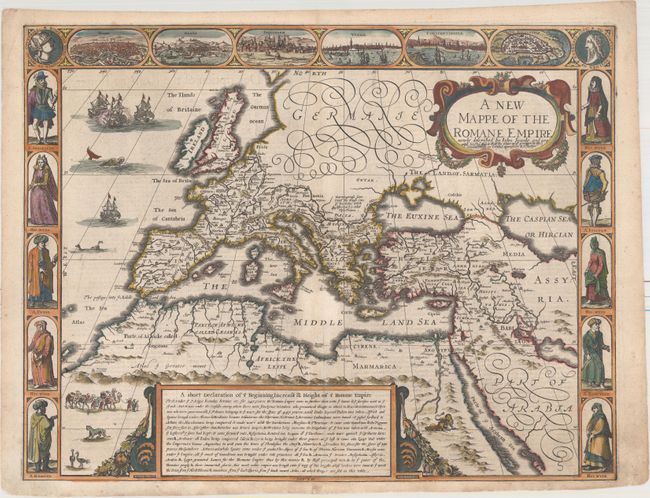
Speed's Carte-a-Figures Map of the Roman Empire
"A New Mappe of the Romane Empire Newly Described ", Speed, John
Subject: Europe
Period: 1662 (circa)
Publication: A Prospect of the Most Famous Parts of the World
Color: Hand Color
Size:
20.1 x 15.5 inches
51.1 x 39.4 cm
This striking map of the Roman Empire focuses on Europe and the regions surrounding the Mediterranean - areas that were dominated by Rome at the height of its empire. At top are views of Rome, Genua, Jerusalem, Venice, Constantinople, and Alexandria, flanked by medallions containing the portraits of Rome and Romulus. At the sides of the map are costumed figures representing the men and women of Spain, Italy, Turkey, Egypt, and Morocco. A large cartouche at bottom gives a brief history of the Roman Empire, with a more in depth discussion on verso. Published by Roger Rea.
References: Shirley (BL Atlases) T.SPE-2d #7.
Condition: B+
Watermarked paper with light toning along the centerfold at bottom and a professionally repaired centerfold separation that enters 3" into map at bottom. Light marginal soiling.