Catalog Archive
Auction 160, Lot 454
"Carte Generale des Royaumes, Etats & Domaines, que les Rois & la Couronne de la Grande-Bretagne ont Possedez ou Possedent en Europe en Afrique & en Amerique", Rapin-Thoyras, Paul de
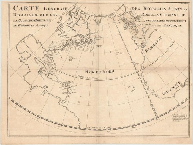
Subject: North Atlantic
Period: 1736 (circa)
Publication: L'Histoire d'Angleterre
Color: Black & White
Size:
21.7 x 16.1 inches
55.1 x 40.9 cm
Download High Resolution Image
(or just click on image to launch the Zoom viewer)
(or just click on image to launch the Zoom viewer)