Catalog Archive
Auction 160, Lot 444

"Peru", Montanus, Arnoldus
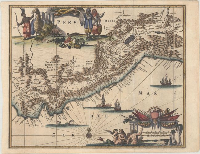
Subject: Peru

Period: 1671 (circa)

Publication: De Nieuwe en Onbekende Weereld

Color: Hand Color

Size:
14.1 x 11.5 inches
35.8 x 29.2 cm
Download High Resolution Image
(or just click on image to launch the Zoom viewer)

Montanus' work was perhaps the greatest illustrated book on the New World produced in the seventeenth century. It contained over one hundred beautifully engraved plates, views, and maps of North and South America. The plates vividly depict forts, festivals, occupations, Dutch fleets, battles, religious rites, and customs of the native inhabitants. This important work was translated into German by Olivier Dapper, and into English by John Ogilby. Several of the plates were later acquired by Pierre Vander Aa.

This attractive map covers Peru with parts of Ecuador and northern Chile. Dense with place names and topographical detail, it provides a marvelous view of the region. The map is oriented with north to the left although the compass rose incorrectly depicts north at top. The decorative title cartouche features natives and exotic fauna (llama, armadillo, snake, and a strange lizard) and the distance scale is ornamented with merfolk and military banners and flags. Galleons and a sea monster complete the lavish composition.

References:

Condition: A

Issued folding, now flattened, on paper with a jester watermark and minor soiling along the right-hand fold. This example has much wider margins than is typically found with Montanus' maps.

Estimate: $275 - $350

Sold for: $325

Closed on 11/16/2016

Archived