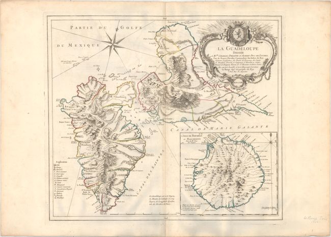
"La Guadeloupe", Le Rouge, George Louis
Subject: Guadeloupe
Period: 1753 (dated)
Publication: Atlas Ameriquain
Color: Hand Color
Size:
21.3 x 18.5 inches
54.1 x 47 cm
This handsome chart shows Guadeloupe. The islands of Basse-Terre and Grande-Terre are depicted in fine topographical detail along with some smaller surrounding islands. A key at bottom left identifies towns, parishes, battlegrounds, batteries, forts both defunct and operational, anchorages, and more. A large inset at bottom right covers Reunion (here called Isle de Bourbon or Mascareigne). The map is adorned with an ornate decorative title cartouche at top right.
References: Sellers & Van Ee #2007; Shirley (BL Atlases) T.LER-3a #26.
Condition: B+
A nice impression and original outline color on watermarked paper with light offsetting, a pair of small worm holes around the centerfold at bottom, and minor toning along the centerfold.