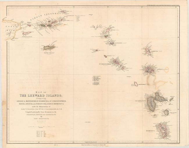
"Map of the Leeward Islands; Comprising Antiqua, Montserrat, Barbuda, St. Christopher, Nevis, Anguilla, Virgin Islands & Dominica…", Arrowsmith, John
Subject: Lesser Antilles
Period: 1839 (dated)
Publication: Papers Relating to the Labouring Population of the West Indies
Color: Hand Color
Size:
23 x 18.3 inches
58.4 x 46.5 cm
A colorful and precisely engraved map of the Leeward Islands with colonial interests named for each island and keyed to a legend. Very fine detail along the coastlines of the major islands. A table lists the parishes in Nevis and St. Christopher. The title continues, "under the Administration of Lieut. Colonel Sir Wm. M.G. Colebrooke, K.C.H. Compiled principally from documents in the Colonial Office and Admiralty." Published by the House of Commons.
References:
Condition: B
Issued folding, now pressed and backed with archival tissue, repairing several long fold separations. There is a little title offsetting and color offsetting from Guadeloupe. Binding trim at left, as issued, with paper laid in to accommodate framing.