Catalog Archive
Auction 160, Lot 390

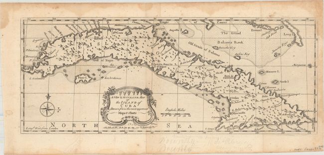
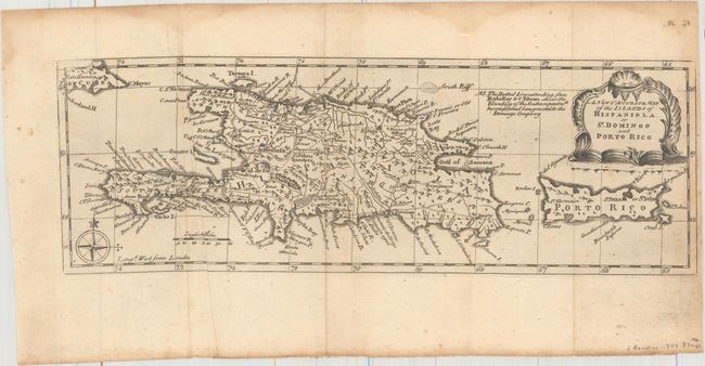
"[Lot of 2] A New & Accurate Map of the Island of Cuba Drawn from the Most Approved Maps & Charts [and] A New & Accurate Map of the Islands of Hispaniola or St. Domingo and Porto Rico", Bowen, Emanuel

Subject: Greater Antilles

Period: 1747 (circa)

Publication: A Complete System of Geography

Color: Black & White

Size:
See Description
Download High Resolution Image
(or just click on image to launch the Zoom viewer)

Attractive pair of maps that were originally issued on a single sheet:

A. A New & Accurate Map of the Island of Cuba Drawn from the Most Approved Maps & Charts (14.6 x 5.8"). A beautifully engraved map of Cuba. Numerous place names surround the coastline, and there is good detail of shoals and rocks to assist in navigation. The map is graced by a charming rococo-style cartouche and a compass rose.

B. A New & Accurate Map of the Islands of Hispaniola or St. Domingo and Porto Rico (13.7 x 4.6"). Covers the full extent of Hispaniola and Puerto Rico, along with the southeastern portion of Cuba. Numerous place names are identified throughout with a network of roads covering the interior.

References: Shirley (BL Atlases) T.BOW-2a #65.1 & #65.2.

Condition: B+

Issued folding with light damp stains mostly in the top and right blank margins. The map of Cuba has several light pencil notations in the bottom blank margin, and the map of Hispaniola has a few extraneous creases adjacent to the folds.

Estimate: $180 - $220

Sold for: $95

Closed on 11/16/2016

Archived