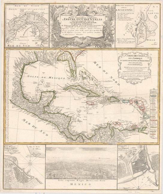
"Mappa Geographica, Complectens I. Indiae Occidentalis Partem Mediam Circum Isthmum Panamensem II. Ipsumq. Isthmum. III. Ichnographiam Praecipuorum Locorum & Portuum ad has Terras Pertinentium...", Homann Heirs
Subject: Gulf of Mexico & Caribbean
Period: 1740 (circa)
Publication:
Color: Hand Color
Size:
19.2 x 22.9 inches
48.8 x 58.2 cm
This informative and very graphic folio sheet has a large map of the region, titled "Carte des Isles de l'Amerique et Deplusieurs Pays de Terre Ferme," attributed to D'Anville (1731). It covers the Gulf of Mexico, Central America and all of the Caribbean islands. It is nicely detailed with a key to show European possessions and a beautifully engraved title cartouche. Above the main map is the large, decorative title cartouche, flanked by insets of the isthmus of Panama and a plan of St. Augustine in Florida. Below the map is a large view of Mexico City, flanked by plans of Vera Cruz and San Domingo. A very handsome sheet, absolutely filled with information on the West Indies.
References:
Condition: A
Original outline color with a few faint spots and a short closed edge tear at left that just touches the border.