Catalog Archive
Auction 160, Lot 375

"America Central. Costa Oeste. Carta de la Bahia de Panama Levantada en 1847 por el Capitan Henry Kellett y el Comr. James Wood...", Direccion de Hidrografia

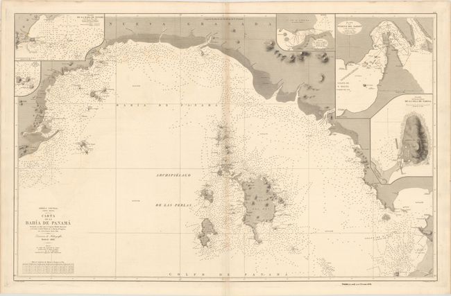
Subject: Gulf of Panama

Period: 1868 (dated)

Publication:

Color: Black & White

Size:
37.4 x 23.8 inches
95 x 60.5 cm
Download High Resolution Image
(or just click on image to launch the Zoom viewer)

This oversized chart depicts the coastline of the Gulf of Panama from Punta Chame to the Rio Congo. The Gulf is filled with soundings, anchorages, rocks, and shoals, as well as the archipelago of the Pearl Islands. Five insets fill the interior, including a close-up of the bay surrounding Panama City and the Bay of San Miguel. Engraved by E. Perez with lettering by S. Bregante. The embossed stamp of the Direccion de Hidrografia is adjacent to the title. The price is stamped below the neatline at bottom right: "Precio 1,2 eseu y en Ultramar 1,5 id."

References:

Condition: B+

Heavy paper with a "J. G. O." watermark and light toning along the centerfold.

Estimate: $350 - $425

Unsold

Closed on 11/16/2016

Archived