Features "Colona" in Today's Colorado
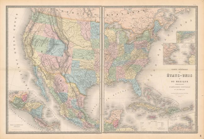
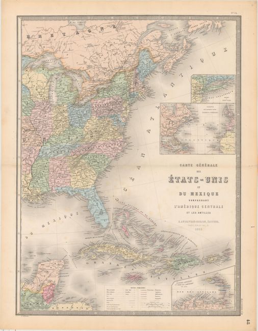
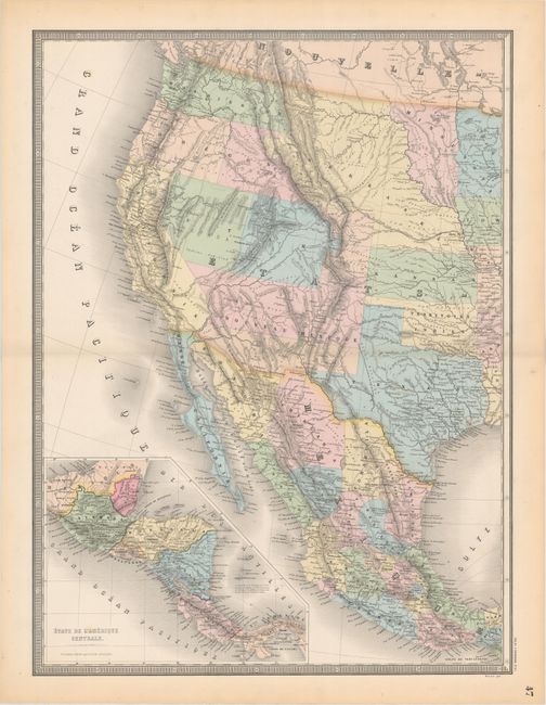
"[On 2 Sheets] Carte Generale des Etats-Unis et du Mexique Comprenant l'Amerique Centrale et les Antilles", Andriveau-Goujon, E.
Subject: United States & Mexico, Civil War
Period: 1862 (dated)
Publication: Atlas Universel
Color: Hand Color
Size:
18.3 x 24.3 inches
46.5 x 61.7 cm
This Civil War period map shows the political rarity of Colona in today's Colorado. Superb provisional western territorial boundaries include Dagotah Territory lying in the region between Minnesota and the Missouri River, Nebraska taking in the rest of the region up to the Rocky Mountains, and Nevada and Utah territories stretching between California and Colona. The large territory of New Mexico has lost its southern third to General Baylor's short-lived Confederate Territory of Arizona. Washington stretches all the way to the Continental Divide. Oregon has gained statehood but lost its eastern lands, destined to eventually become the southern portion of Idaho, here named Shoshone and only extending up to Washington; a most unusual configuration. The map details major wagon and emigrant roads, railroads, forts and much more. It extends to show all of Mexico, Guatemala and the Caribbean. Insets show the Petite Antilles, Central America, the Atlantic Ocean, and Long Island.
References:
Condition: B+
Nice impressions with occasional faint spots of foxing and light toning along sheet edges. The eastern sheet has short fold separations at left and right confined to the blank margins.