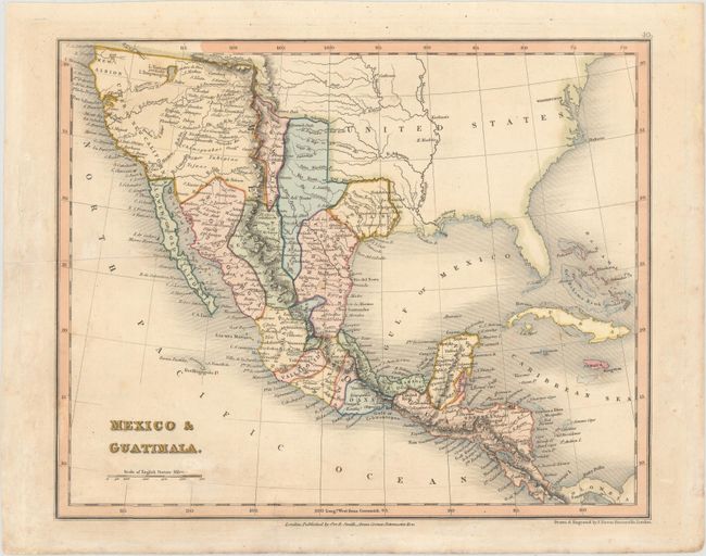
"Mexico & Guatimala", Dower, John
Subject: United States & Mexico
Period: 1835 (circa)
Publication: General Atlas of the World
Color: Hand Color
Size:
10.2 x 8.2 inches
25.9 x 20.8 cm
A nicely detailed map that shows an early Texas as part of the state of San Luis Potosi in Mexico, with San Antonio named. California and the Southwest are also part of Mexico. A number of non-existent rivers flow from both the fictitious L. Timpanogos and L. Teguayo (probably Salt Lake), including the Buenaventura, S. Felipe, and Los Mongos. New Mexico is wedged between unnamed Mexican regions. It includes all of Upper or New California naming San Francisco, San Luis Obispo, Santa Barbara, San Diego, as well as other missions and settlements. The Baja Peninsula is labeled Lower or Old California. Locates many Indian tribes, forts and early settlements.
References:
Condition: B+
Original color with a crease at left and light soiling.