Catalog Archive
Auction 160, Lot 321

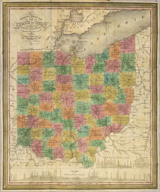
"The Tourist's Pocket Map of the State of Ohio Exhibiting its Internal Improvements, Roads, Distances, &c", Mitchell, Samuel Augustus

Subject: Ohio

Period: 1833 (dated)

Publication:

Color: Hand Color

Size:
12.8 x 15.3 inches
32.5 x 38.9 cm
Download High Resolution Image
(or just click on image to launch the Zoom viewer)

This finely engraved, early edition pocket map of Ohio is printed on thin, banknote-style paper. Counties are delineated in color and the map depicts many roads, towns, and watershed. The bottom of the map contains a profile of the Ohio and Erie Canal. The map folds into original, green leather covers with decorative border and title in gilt measuring 3 x 5". The inside cover lists 73 counties along with their 1830 census population.

References: Ristow pp. 303-304.

Condition: B+

Issued folding with light offsetting and a few tiny rust spots. Covers show light wear.

Estimate: $300 - $375

Sold for: $200

Closed on 11/16/2016

Archived