Catalog Archive
Auction 160, Lot 308

"Map of Public Surveys in Nevada Territory to Accompany Report of Surveyor Genl.", General Land Office
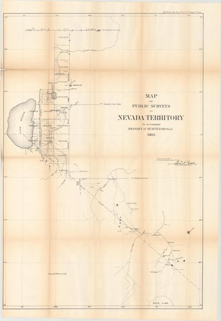
Subject: Nevada

Period: 1862 (dated)

Publication: HR Exec. Doc. No. 1, 37th Cong., 3d Sess.

Color: Black & White

Size:
20.2 x 29.8 inches
51.3 x 75.7 cm
Download High Resolution Image
(or just click on image to launch the Zoom viewer)

Nevada existed as a territory for only three years, so maps showing this form are fairly scarce. This is the earliest General Land Office map of Nevada. The map extends to show much of the Truckee River to the north and south to Aurora and just the tip of Mono Lake. There are some towns and villages, ranches, a few roads, and watershed with limited topographical information. From 1850 to 1861 the Utah territorial government exercised control over the area of today's Nevada. The discovery of the Comstock Lode in June 1860 and the outbreak of the Civil War led to the establishment of the Nevada Territory on March 2, 1861. This map graphically illustrates the scanty knowledge of the area. As typical for the time, Lake Tahoe is misshapen and here called Lake Bigler. The map names Carson City, Virginia City, Genoa, 5 Mile Ranch, Nye's Ranch, and more. It was made in the San Francisco office of the GLO and is signed in the plate by E.F. Beale. Beale [1822-1893] had a long and varied career in the West including Indian Agent, surveyor, camel driver and wagon-road builder. When this map was made, he was the Surveyor General to California and Nevada. A year earlier he requested a Union Army command, but Lincoln persuaded him to remain as surveyor general and help keep California in the Union.

References:

Condition: B

Issued folding with light toning along the folds, a 2.5" fold separation at top left, some tiny splits at the fold intersections, and a hint of offsetting.

Estimate: $100 - $130

Sold for: $90

Closed on 11/16/2016

Archived