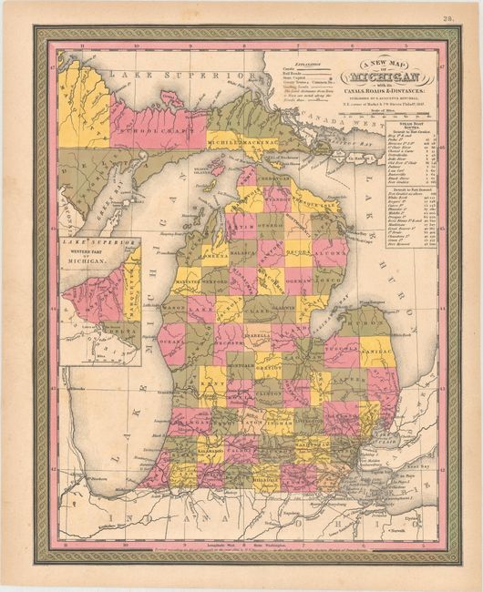
"A New Map of Michigan with Its Canals, Roads & Distances", Mitchell, Samuel Augustus
Subject: Michigan
Period: 1847 (dated)
Publication: New Universal Atlas
Color: Hand Color
Size:
11.6 x 14.6 inches
29.5 x 37.1 cm
Attractive, colorful map with county development throughout, but no settlement beyond Saginaw, with the notable exception of Mackinaw Island. Railroads are shown only in the extreme southern portion of the state. Includes an inset of the western tip of the Upper Peninsula, showing Ontonagon County and parts of Marquette, Houghton and Delta counties. The table to the right gives the cities and distances along the steamboat routes from Detroit to Fort Gratiot and then continuing to Fort Howard. County configuration is current for 1845, prior to the organization of Houghton County. The map is adorned with calligraphic title and scroll borders.
References:
Condition: A
Full original color with a few spots of foxing and light toning along the edges of the sheet.