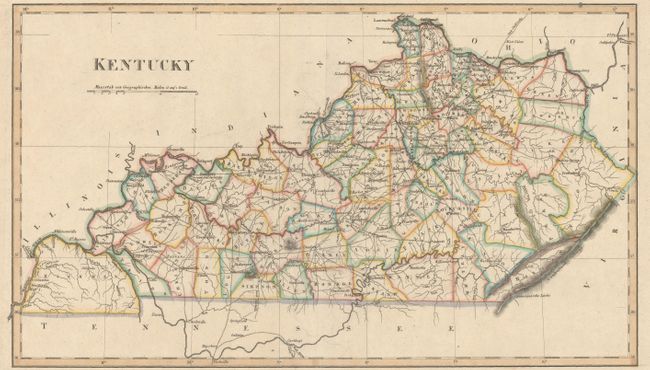
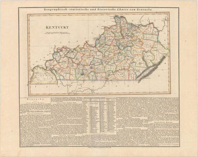
"Geographisch-Statistische und Historische Charte von Kentucky", Weimar Geographisches Institut
Subject: Kentucky
Period: 1826 (dated)
Publication:
Color: Hand Color
Size:
18.3 x 10.5 inches
46.5 x 26.7 cm
This is an uncommon German edition of Carey & Lea's map of Kentucky with related text below the map image. The atlas was issued in six editions in English, French and German between 1822 and 1827. The map depicts a surprisingly substantial network of roads in the state along with early town, rivers, and topography. County configuration is current to 1820 with the southwestern part of the state occupied entirely by Hickman County. In 1821, the counties of Graves, Calloway, and McCracken would be organized from Hickman. On a full folio sheet that measures 20.4 x 17.9".
References: Phillips (A) #1225-19.
Condition: A
A nice impression on a clean sheet with a bit of faint offsetting, else fine.