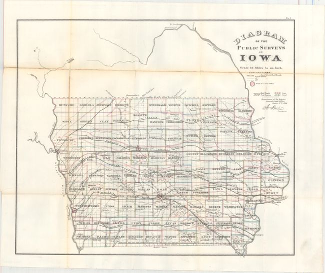
"Diagram of the Public Surveys in Iowa", General Land Office
Subject: Iowa
Period: 1866 (dated)
Publication:
Color: Hand Color
Size:
19.8 x 16.8 inches
50.3 x 42.7 cm
This is a great map that locates, with hand coloring, the regions of coal, iron and lead deposits. Good detail of existing railroads includes the Dubuque and Pacific, Cedar Rapids and Missouri River, Mississippi and Missouri, and the Burlington and Missouri River. Each county is named and Land Office seats located. Signed in the plate by Jos. S. Wilson, Commissioner for the General Land Office.
References:
Condition: B
Issued folding with light toning along the folds. Numerous fold separations along the toned folds have been repaired on verso with archival tape.