"Topographic Map of the Island of Lanai Maui County, Hawaii", U.S. Geological Survey (USGS)
Subject: Lanai, Hawaii
Period: 1925 (dated)
Publication:
Color: Printed Color
Size:
20.1 x 18.3 inches
51.1 x 46.5 cm
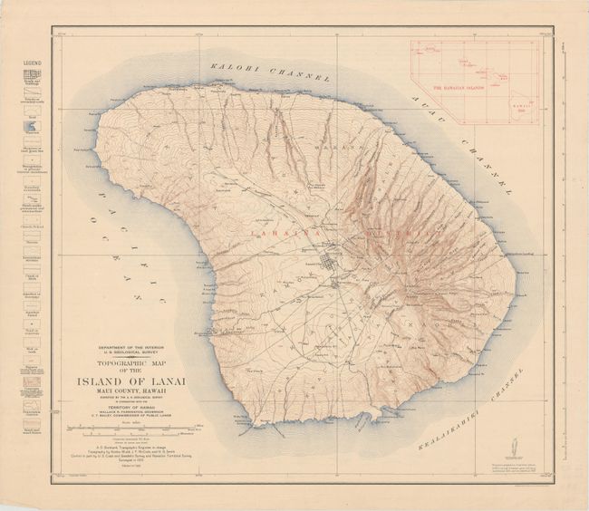
This handsome and intricately detailed map shows the topography of the island. The map is based on a survey done in 1923, with topography by Kostka Mudd, J.F. McCook, and H.B. Smith, under the direction of A.O. Burkland. It identifies towns and cities, political divisions, roads, trails, churches, schools, streams, canals, aqueducts, elevations, sand dunes, and more. There is an inset at top right showing the relative locations of all the Hawaiian Islands. The verso includes text on how to use the topographical maps produced by the United States Geological Survey as well as a legend to conventional symbols used on the maps.
References:
Condition: A
Minor soiling with a short edge tear in the right blank margin.