Catalog Archive
Auction 160, Lot 267

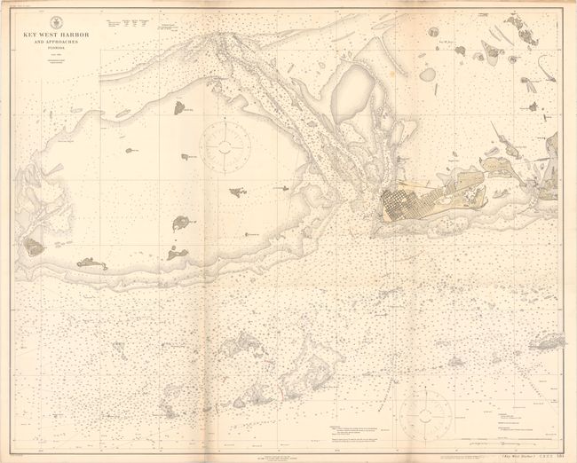
"Key West Harbor and Approaches Florida", U.S. Coast & Geodetic Survey

Subject: Florida

Period: 1919 (dated)

Publication:

Color: Printed Color

Size:
41.9 x 33.7 inches
106.4 x 85.6 cm
Download High Resolution Image
(or just click on image to launch the Zoom viewer)

This is a later and larger edition chart which was first published by the Coast Survey in 1851. Based upon surveys from 1850-1914, the chart depicts the area from Key West and Stock Island west to Boca Grande Key. The individual street grid for the town of Key West is depicted in good detail, and the impressive navigational information in the surrounding waters include soundings, shoals, jetties, beacons and buoys. This is chart #584, priced at 50 cents in the top left corner of the sheet.

References:

Condition: B+

Issued folding with faint toning and soiling along the left fold. There are a few additional faint spots and minor pencil notations, but an otherwise clean, attractive example.

Estimate: $150 - $180

Sold for: $75

Closed on 11/16/2016

Archived