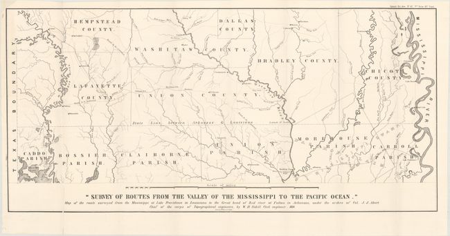
"Survey of Routes from the Valley of the Mississippi to the Pacific Ocean. Map of the Route Surveyed from the Mississippi at Lake Providence in Louisiana to the Great Bend of Red River...", U.S. Corps of Engineers
Subject: Arkansas, Louisiana
Period: 1850 (dated)
Publication: Sen. Doc. 42, 31st Congress, 2nd Session
Color: Black & White
Size:
30.6 x 14.7 inches
77.7 x 37.3 cm
This map was issued with William Henry Sidell's "Survey of a route for a railroad from the Great Bend, on Red River, to Providence, on the Mississippi River." It shows several routes to be examined from the Mississippi River to the Louisiana/Texas boundary and depicts early county and parish configurations. The Bastrop Claim is shown extending into Arkansas.
William Henry Sidell (1810-73) was educated at West Point, and turned his attention to civil engineering at a time when the railroad system was first developing. He attained the rank of Brevet Brigadier General for his services during the Mexican War and the Civil War.
References:
Condition: A
Issued folding on a clean bright sheet with a few tiny splits at fold intersections and a small chip in the top left corner that has been replaced with archival tissue. There are very short edge tears in the blank margins.