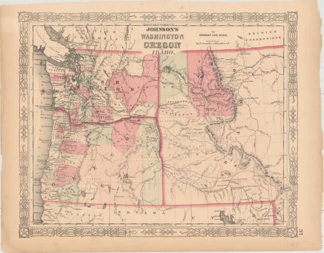
"Johnson's Washington Oregon and Idaho", Johnson & Ward
Subject: Northwestern United States
Period: 1863-64 (circa)
Publication:
Color: Hand Color
Size:
15.6 x 12.8 inches
39.6 x 32.5 cm
A nice map of the northwest, with an enlarged Idaho Territory incorporating present-day western Montana. Gold discoveries in Clearwater Country, Idaho, in September 1860 led to an influx of thousand of miners into the region. Idaho was organized as a territory in July 1863 and Montana was separated as a territory in May 1864, thus this map was issued for only a short period of time. The areas of the Solomon River and the Nez Perce mines are shown as are other mining centers. Fort Boise is shown on the Oregon & Idaho border.
References:
Condition: B+
There are a few small spots in the image and several edge tears confined to the blank margins.