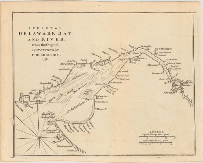
"A Chart of Delaware Bay and River, from the Original by Mr. Fisher of Philadelphia. 1776 ", Anon.
Subject: Colonial Mid-Atlantic United States
Period: 1779 (published)
Publication: Gentleman's Magazine
Color: Black & White
Size:
9.3 x 7.3 inches
23.6 x 18.5 cm
This Revolutionary War map was based on the chart Joshua Fisher made of Delaware Bay in 1756 and expanded upon in 1776. Fisher's map was the most important map of the bay and river in the eighteenth century. This map was derived from the 1776 edition and was published with an article updating the British public on the war in the colonies. The map shows the bay and beyond to Philadelphia and is filled with place names and the location of many hazards to navigation along the waterway. It locates Cape May, Turtle Gut Inlet, Cape James, Egg Island, Salem, and much more. Two distance scales are featured at bottom right, and the direction rose with fleur-de-lis orients north to the right. Published in the July 1779, issue of the Gentleman's Magazine.
References: Jolly #GENT-268; Sellers & Van Ee #1372.
Condition: B+
Issued folding with light offsetting.