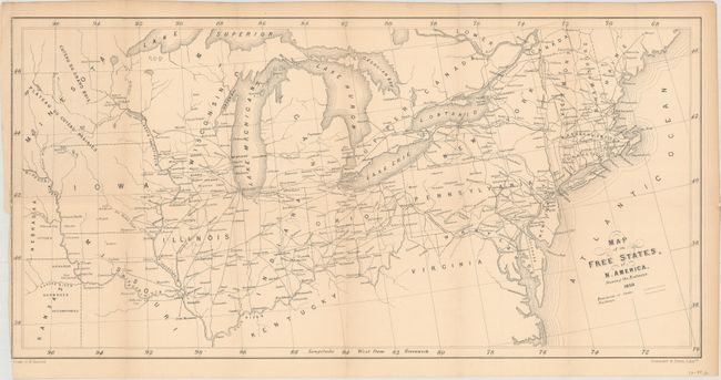
"Map of the Free States of N. America, Shewing the Railways", Stannard & Dixon
Subject: Eastern United States
Period: 1859 (dated)
Publication:
Color: Black & White
Size:
22.9 x 11.4 inches
58.2 x 29 cm
This railroad map of the northern United States was published in William Hancock's An Emigrant's Five Years in the Free States of America shortly before the onset of the Civil War. It shows the extent of railroad development spanning from the eastern seaboard to the Mississippi River, as well as the paths of Chesapeake and Erie canals. There is virtually no detail in the bordering states of Kentucky and Virginia. Lithographed by Stannard & Dixon.
References: Phillips (Maps) p. 908; Howes #H153; Sabin #30192.
Condition: B+
Issued folding with light toning and a 3" binding tear at left closed on verso with archival tape.