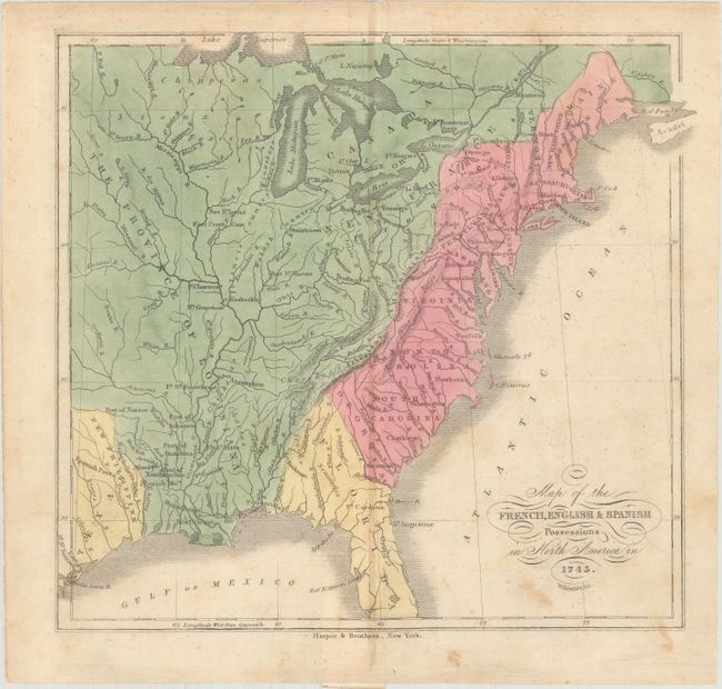
"Map of the French, English & Spanish Possessions in North America in 1745", Kemble, W.
Subject: Colonial Eastern United States
Period: 1846 (circa)
Publication:
Color: Hand Color
Size:
8.5 x 7.9 inches
21.6 x 20.1 cm
This handsome map originally appeared in J.W. Monette's History of the Discovery and Settlement of the Valley of the Mississippi.... It depicts the English possessions spanning from Georgia to Maine along the east coast. Spain's possessions include Florida and a small portion of Texas (also featuring the name New Philippine). The remainder of the map is labeled the Province of Louisiana and is under French control. Towns and cities, Indian tribes, forts, rivers, and mountains are identified throughout. Published by Harper & Brothers.
References:
Condition: B+
There is light scattered foxing, a hint of toning along the centerfold, and a few minor creases.