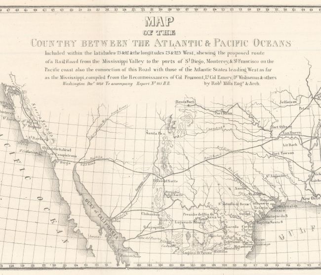
"Map of the Country Between the Atlantic & Pacific Oceans...", Mills, Robert
Subject: United States
Period: 1852 (circa)
Publication:
Color: Black & White
Size:
32 x 10.5 inches
81.3 x 26.7 cm
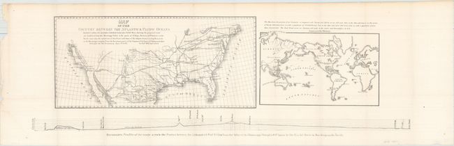
This sheet composed of three maps puts forth the concepts of Mills and Asa Whitney for a transcontinental railroad system. The first map by Mills shows the proposed route from Little Rock to San Diego and north to San Francisco, as well as how the proposed route would connect with the existing railroad system in the eastern US. The second, constructed by Whitney, is a world map with the RR continuing on to the Columbia River via San Francisco, showing the global trade opportunities the route would provide. Below the two maps is a barometric profile of the route. Size is for the sheet; the first map measures 16.5 x 8" and the world map measures 10 x 6".
References:
Condition: A
A clean example, issued folding, with a few minor misfolds in the bottom corners of the sheet.