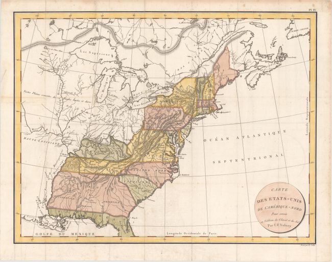
"Carte des Etats-Unis de l'Amerique-Nord pour Servir au Tableau du Climat et du Sol", Volney, C. F.
Subject: Eastern United States & Canada
Period: 1803 (circa)
Publication:
Color: Hand Color
Size:
22.2 x 17.1 inches
56.4 x 43.4 cm
A nicely engraved copper-plate map that extends from northern Florida well into Canada to include the Maritimes. The map extends westward to beyond the Mississippi River. It locates some Indian tribes and gives the number of warriors in each, such as Pays des Chactas (2000 Guerriers). The hardwood forest in western Tennessee is nicely detailed and bounded by the Mississippi River. Extensive hachure is used in an attempt to illustrate the complex ranges of the Allegheny Mountains. The map names major cities only. Climatic zones are noted with engraved line and label. Circular title cartouche. Engraved by E. Collin.
References:
Condition: A
A crisp impression issued folding on watermarked paper with faint offsetting, a hint of toning along a fold at left, and minor scattered foxing that is mostly confined to the blank margins. There are some short fold separations in the blank margins that have been closed on verso with archival tape.