Catalog Archive
Auction 160, Lot 113

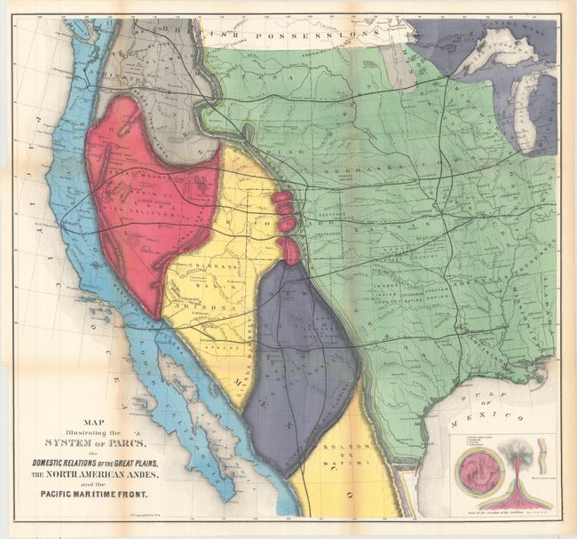
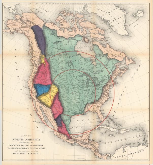
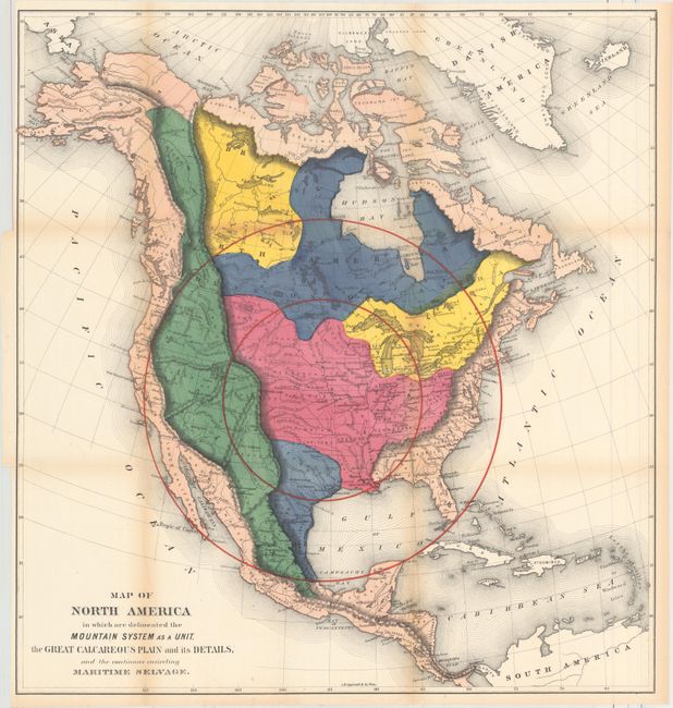
"[Lot of 3] Map Illustrating the System of Parcs, the Domestic Relations of the Great Plains... [and] Map of North America Delineating the Mountain System and Its Details... [and] Map of North America in Which Are Delineated the Mountain System...", Gilpin, William

Subject: North America

Period: 1874 (circa)

Publication: Mission of the North American People, Geographical, Social and Political

Color: Hand Color

Size:
See Description
Download High Resolution Image
(or just click on image to launch the Zoom viewer)

This lot includes three maps from the second edition of William Gilpin’s Mission of the North American People, Geographical, Social and Political. Gilpin was the first governor of the territory of Colorado and a proponent of the concept of Manifest Destiny, the transcontinental railway, and a westward expansion of the United States. He had radical ideas on how and why America should be populated, and to support his theories he did a series of maps including these three. Interestingly, they were some of the first to show economic potential for the West and to think in terms of regional resources and climates.

A. Map Illustrating the System of Parcs, the Domestic Relations of the Great Plains, the North American Andes, and the Pacific Maritime Front, (23.1 x 21.3"). This is a fascinating and colorful map of the western United States. The map is divided into regions with a System of Parcs following the Continental Divide. Several railroads bisect the West including the Texas Pacific, Atlantic and Pacific, Kansas Pacific, Union Pacific and North Pacific. Several railroads are not named including two that extend south though Mexico. Also includes details of the Indian Reservations, forts and watershed.

B. Map of North America Delineating the Mountain System and Its Details, the Great Calcareous Plain as a Unit, and the Continuous Encircling Maritime Selvage, (22.4 x 23.9"). The map uses bold coloring to suggest related regions and uses concentric circles, which Gilpin used to represent the future population density with the center of population at Topeka, Kansas.

C. Map of North America in Which Are Delineated the Mountain System as a Unit, the Great Calcareous Plain and Its Details, and the Continuous Encircling Maritime Selvage, (22.4 x 23.9"). Based upon Alexander von Humboldt's "isothermal zodiac," this map of North America shows a temperate range south of the 40th parallel. Gilpin was a strong believer in climate influencing economic development, and the map suggests that the United States was well positioned to benefit from the favorable conditions.

References:

Condition: B+

Crisp impressions with very strong hand coloring. Light toning along the folds and sheet edges, otherwise near fine.

Estimate: $250 - $325

Sold for: $180

Closed on 11/16/2016

Archived